 Southern Gila Highlands/Black Range-
Southern Gila Foothills/Mimbres Valley-
Eastern Black Range Foothills-Sierra County Lakes-
Northern Dona Ana County-Central Tularosa Basin-
West Slopes Sacramento Mountains Below 7500 Feet-
Sacramento Mountains Above 7500 Feet-
East Slopes Sacramento Mountains Below 7500 Feet-
Including the cities of Silver City, Lake Roberts, Kingston,
Fort Bayard, Mimbres, Hurley, Faywood, Grant County Airport,
Hillsboro, Winston, Truth Or Consequences, Derry, Spaceport,
Garfield, Hatch, Radium Springs, Alamogordo, Tularosa,
White Sands Monument, Mescalero, Timberon, Mountain Park,
Cloudcroft, Sunspot, Apache Summit, Mayhill, Pinon,
and Sacramento
304 PM MDT Mon Jul 31 2017
...FLASH FLOOD WATCH IN EFFECT FROM 6 PM MDT THIS EVENING THROUGH
TUESDAY MORNING...
The National Weather Service in El Paso Tx/Santa Teresa has
issued a
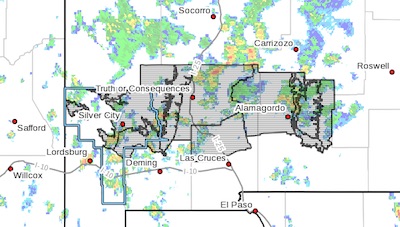
* Flash Flood Watch for the Sacramento Mountains, northern Otero
County, Sierra County, northern Dona Ana County and the Black
Range of Grant County
* From 6 PM MDT this evening through Tuesday morning
* Rainfall amounts of 2 to 4 inches tonight could lead to flash
flooding, especially of low water crossings and other flood
prone area.
* Flooding could close roads and in isolated cases may get into
some buildings. If you witness flooding, immediately move to
higher ground.
PRECAUTIONARY/PREPAREDNESS ACTIONS...
A Flash Flood Watch means that conditions may develop that lead
to flash flooding. Flash flooding is a VERY DANGEROUS SITUATION.
You should monitor later forecasts and be prepared to take action
should Flash Flood Warnings be issued.