wind advisory 0307 and 0308 2019
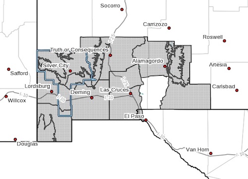
Upper Gila River Valley-Southern Gila Highlands/Black Range-
Southern Gila Foothills/Mimbres Valley-
Southwest Desert/Lower Gila River Valley-Lowlands of the Bootheel-
Uplands of the Bootheel-Southwest Desert/Mimbres Basin-
Eastern Black Range Foothills-Sierra County Lakes-
Northern Dona Ana County-Southern Dona Ana County/Mesilla Valley-
Central Tularosa Basin-

West Slopes Sacramento Mountains Below 7500 Feet-
Sacramento Mountains Above 7500 Feet-
East Slopes Sacramento Mountains Below 7500 Feet-Otero Mesa-
Western El Paso County-
Including the cities of Cliff, Buckhorn, Gila Hot Springs,
Mule Creek, Silver City, Lake Roberts, Kingston, Fort Bayard,
Mimbres, Hurley, Faywood, Grant County Airport, Lordsburg,
Red Rock, Virden, Antelope Wells, Animas, Hachita, Cloverdale,
Deming, Columbus, Hillsboro, Winston, Truth Or Consequences,
Derry, Spaceport, Garfield, Hatch, Radium Springs, Las Cruces,
Vado, Sunland Park, Alamogordo, Tularosa, White Sands Monument,
Mescalero, Timberon, Mountain Park, Cloudcroft, Sunspot,
Apache Summit, Mayhill, Pinon, Sacramento, Crow Flats,
Downtown El Paso, West El Paso, and Upper Valley
528 AM MST Thu Mar 7 2019

...WIND ADVISORY IN EFFECT FROM 11 AM THIS MORNING TO 7 PM MST
THIS EVENING...
...HIGH WIND WATCH IN EFFECT FROM FRIDAY AFTERNOON THROUGH FRIDAY
EVENING...

The National Weather Service in El Paso Tx/Santa Teresa has
issued a Wind Advisory, which is in effect from 11 AM this
morning to 7 PM MST this evening. A High Wind Watch has also been
issued. This High Wind Watch is in effect from Friday morning
through Friday evening.

* TIMING...Winds will increase late this morning and reach their
peak speeds mid to late afternoon, before diminishing around
sunset.

* WINDS...Winds of 25 to 35 mph with a few gusts to 45 mph.

* IMPACTS...Gusty winds will create minor driving problems,
especially high profile vehicles. Blowing dust may become
significant hazard from Deming west due to poor visibilities.

PRECAUTIONARY/PREPAREDNESS ACTIONS...

A Wind Advisory means that winds of 35 mph are expected. Winds
this strong can make driving difficult, especially for high
profile vehicles. Use extra caution.

A High Wind Watch means there is the potential for a hazardous
high wind event. Sustained winds of at least 40 mph, or gusts of
58 mph or stronger may occur. Continue to monitor the latest
forecasts.

Content on the Beat

WARNING: All articles and photos with a byline or photo credit are copyrighted to the author or photographer. You may not use any information found within the articles without asking permission AND giving attribution to the source. Photos can be requested and may incur a nominal fee for use personally or commercially.

Disclaimer: If you find errors in articles not written by the Beat team but sent to us from other content providers, please contact the writer, not the Beat. For example, obituaries are always provided by the funeral home or a family member. We can fix errors, but please give details on where the error is so we can find it. News releases from government and non-profit entities are posted generally without change, except for legal notices, which incur a small charge.

NOTE: If an article does not have a byline, it was written by someone not affiliated with the Beat and then sent to the Beat for posting.

Images: We have received complaints about large images blocking parts of other articles. If you encounter this problem, click on the title of the article you want to read and it will take you to that article's page, which shows only that article without any intruders. 

New Columnists: The Beat continues to bring you new columnists. And check out the old faithfuls who continue to provide content.

Newsletter: If you opt in to the Join GCB Three Times Weekly Updates option above this to the right, you will be subscribed to email notifications with links to recently posted articles.

Submitting to the Beat

Those new to providing news releases to the Beat are asked to please check out submission guidelines at https://www.grantcountybeat.com/about/submissions. They are for your information to make life easier on the readers, as well as for the editor.

Advertising: Don't forget to tell advertisers that you saw their ads on the Beat.

Classifieds: We have changed Classifieds to a simpler option. Check periodically to see if any new ones have popped up. Send your information to editor@grantcountybeat.com and we will post it as soon as we can. Instructions and prices are on the page.

Editor's Notes

It has come to this editor's attention that people are sending information to the Grant County Beat Facebook page. Please be aware that the editor does not regularly monitor the page. If you have items you want to send to the editor, please send them to editor@grantcountybeat.com. Thanks!

Here for YOU: Consider the Beat your DAILY newspaper for up-to-date information about Grant County. It's at your fingertips! One Click to Local News. Thanks for your support for and your readership of Grant County's online news source—www.grantcountybeat.com

Feel free to notify editor@grantcountybeat.com if you notice any technical problems on the site. Your convenience is my desire for the Beat.  The Beat totally appreciates its readers and subscribers!  

Compliance: Because you are an esteemed member of The Grant County Beat readership, be assured that we at the Beat continue to do everything we can to be in full compliance with GDPR and pertinent US law, so that the information you have chosen to give to us cannot be compromised.