 Upper Gila River Valley-Southern Gila Highlands/Black Range-
Southern Gila Foothills/Mimbres Valley-
Southwest Desert/Lower Gila River Valley-Lowlands of the Bootheel-
Uplands of the Bootheel-Eastern Black Range Foothills-
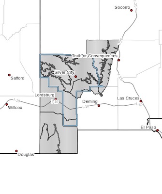
Including the cities of Cliff, Buckhorn, Gila Hot Springs, Mule Creek, Silver City, Lake Roberts, Kingston, Fort Bayard, Mimbres, Hurley, Faywood, Grant County Airport, Lordsburg, Red Rock, Virden, Antelope Wells, Animas, Hachita, Cloverdale, Hillsboro, and Winston
337 PM MDT Fri Aug 9 2019
...FLASH FLOOD WATCH IN EFFECT FROM 2 AM MDT TONIGHT THROUGH LATE SATURDAY NIGHT...
The National Weather Service in El Paso Tx/Santa Teresa has issued a
* Flash Flood Watch for a portion of southwest New Mexico, including the Bootheel, Gila valleys, foothills and mountains, as well as the Mimbres Valley.
* From 2 AM MDT Saturday through late Saturday night
* Increasing coverage of rain showers and thunderstorms will develop and move over the region from the south overnight. Deep monsoon moisture will allow for some of these storms to produce very heavy rainfall. Rainfall rates of 1 to 3 inches per hour will be possible. General rainfall of near 1 inch is expected over large areas, but some locations could see over 2 inches of rain overnight through Saturday evening which could produce flash flooding.
* Rapidly rising water in washes and stream may flood low water crossings. Moving water may be strong enough to carry people and vehicles downstream. Never cross a flooded road. Flood prone area may also becoming inundated by flood waters as water ponds in low lying areas.
PRECAUTIONARY/PREPAREDNESS ACTIONS...
A Flash Flood Watch means that conditions may develop that lead to flash flooding. Flash flooding is a VERY DANGEROUS SITUATION.
You should monitor later forecasts and be prepared to take action should Flash Flood Warnings be issued.