 FIRE WEATHER WATCH IN EFFECT FOR WEDNESDAY AFTERNOON FOR THE GILA FOREST, BLACK RANGE, AND FOR SOUTHWEST NEW MEXICO.. .A warm dry airmass continue to sit across the southwest U.S. On Wednesday an approaching upper level storm system will increase afternoon winds. With min RH's near 10% and southwest winds near 20 mph, we will see low end Red Flag conditions Wednesday afternoon and early evening for parts of southwest New Mexico and the Gila Region. Conditions will improve after sunset when temperatures decrease and winds become light and terrain- driven. Our warm dry weather will continue through the end of the week, but winds look to stay below critical levels.
...RED FLAG WARNING IN EFFECT FROM NOON TO 9 PM MDT WEDNESDAY FOR
WARM, DRY, AND WINDY CONDITIONS...
The National Weather Service in El Paso Tx/Santa Teresa has
issued a Red Flag Warning, which is in effect from noon to 9 PM
MDT Wednesday. The Fire Weather Watch is no longer in effect.
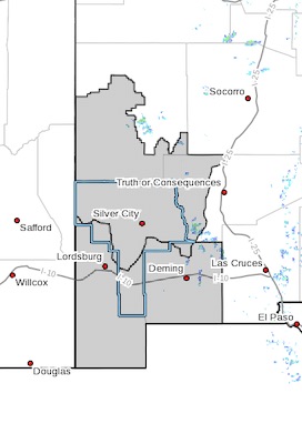
* AFFECTED AREA...Fire weather zones 110 and 111. This includes
the Gila region and the Southwest Deserts and Bootheel of
southwest New Mexico.
* WIND...Southwest at 15 to 20 mph with gusts 25 to 30 mph.
* HUMIDITY...Minimum values between 8 and 14 percent.
* IMPACTS...any fires that develop will likely spread rapidly.
Outdoor burning is not recommended.
PRECAUTIONARY/PREPAREDNESS ACTIONS...
A Red Flag Warning means that critical fire weather conditions
are either occurring now, or will shortly. A combination of
strong winds, low relative humidity, and warm temperatures can
contribute to extreme fire behavior.