 Southwest Desert/Mimbres Basin-Northern Dona Ana County-
Southern Dona Ana County/Mesilla Valley-
West Slopes Sacramento Mountains Below 7500 Feet-
Sacramento Mountains Above 7500 Feet-
East Slopes Sacramento Mountains Below 7500 Feet-Otero Mesa-
West Central Tularosa Basin/White Sands-
Eastern/Central El Paso County-
Northern Hudspeth Highlands/Hueco Mountains-Salt Basin-
Southern Hudspeth Highlands-
Rio Grande Valley of Eastern El Paso/Western Hudspeth Counties-
Rio Grande Valley of Eastern Hudspeth County-
Including the cities of Deming, Columbus, Garfield, Hatch,
Radium Springs, Las Cruces, Vado, Sunland Park, Mescalero,
Timberon, Mountain Park, Cloudcroft, Sunspot, Apache Summit,
Mayhill, Pinon, Sacramento, Crow Flats,
White Sands National Park, Chaparral,
White Sands Range Headquarters, East and Northeast El Paso,
Socorro, Fort Bliss, Hueco Tanks, Loma Linda, Cornudas,
Dell City, Salt Flat, Sierra Blanca, Fabens, Fort Hancock,
Tornillo, and Indian Hot Springs
137 AM MST Wed Jan 10 2024
...HIGH WIND WARNING IN EFFECT FROM 10 AM THURSDAY TO MIDNIGHT
MST THURSDAY NIGHT...
* WHAT...West winds 35 to 45 mph with gusts up to 65 mph
expected.
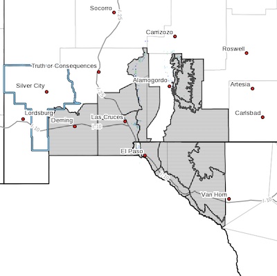
* WHERE...Portions of south central and southwest New Mexico and
southwest Texas.
* WHEN...From 10 AM Thursday to midnight MST Thursday night.
* IMPACTS...Damaging winds will blow down trees and power lines.
Widespread power outages are expected. Travel will be
difficult, especially for high profile vehicles.
* ADDITIONAL DETAILS...Areas of blowing dust may reduce
visibility along the International Border and near known dust
sources.
PRECAUTIONARY/PREPAREDNESS ACTIONS...
People should avoid being outside in forested areas and around
trees and branches. If possible, remain in the lower levels of
your home during the windstorm, and avoid windows. Use caution if
you must drive.