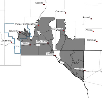
 Southern Gila Foothills/Mimbres Valley-Southwest Desert/Mimbres Basin-Sierra County Lakes-Northern Dona Ana County-Southern Dona Ana County/Mesilla Valley-Otero Mesa-Central Grant County/Silver City Area-East Central Tularosa Basin/Alamogordo-Southeast Tularosa Basin-Western El Paso County-Northern Hudspeth Highlands/Hueco Mountains-Salt Basin-Southern Hudspeth Highlands / Rio Grande Valley of Eastern El Paso/Western Hudspeth Counties-Rio Grande Valley of Eastern Hudspeth County-Including the cities of Cornudas, Tornillo, Mimbres, Indian Hot Springs, Grant County Airport, Hatch, Hueco Tanks, Alamogordo, Spaceport, Fabens, Loma Linda, Dell City, Fort Bayard, Sunland Park, Holloman AFB, Garfield, Derry, Downtown El Paso, Columbus, Orogrande, Faywood, Deming, Vado, Las Cruces, Radium Springs,
Silver City, Salt Flat, Tularosa, Upper Valley, West El Paso,
Truth Or Consequences, Hurley, Fort Hancock, Sierra Blanca, and Crow Flats 305 AM MST Mon Feb 26 2024
...WIND ADVISORY IN EFFECT FROM 9 AM TO 11 PM MST TUESDAY...
* WHAT...West winds 30 to 40 mph with gusts up to 60 mph expected.
* WHERE...Portions of south central and southwest New Mexico and
southwest Texas.
* WHEN...From 9 AM to 11 PM MST Tuesday.
* IMPACTS...Gusty winds will blow around unsecured objects. Tree
limbs could be blown down and a few power outages may result.
PRECAUTIONARY/PREPAREDNESS ACTIONS...
Winds this strong can make driving difficult, especially for high
profile vehicles. Use extra caution.
Secure outdoor objects.