


Weather
Heat Advisory-2-0805-080723
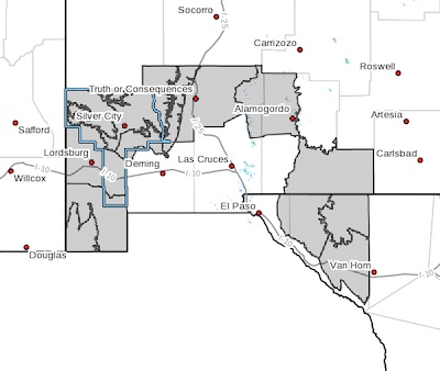 Upper Gila River Valley-Southern Gila Highlands/Black Range-
Southern Gila Foothills/Mimbres Valley-
Southwest Desert/Lower Gila River Valley-Lowlands of the Bootheel-
Uplands of the Bootheel-Eastern Black Range Foothills-Sierra County Lakes-Central Tularosa Basin-Otero Mesa-
Northern Hudspeth Highlands/Hueco Mountains-Salt Basin-Southern Hudspeth Highlands-
Including the cities of Cliff, Buckhorn, Gila Hot Springs,
Mule Creek, Silver City, Lake Roberts, Kingston, Fort Bayard,
Mimbres, Hurley, Faywood, Grant County Airport,
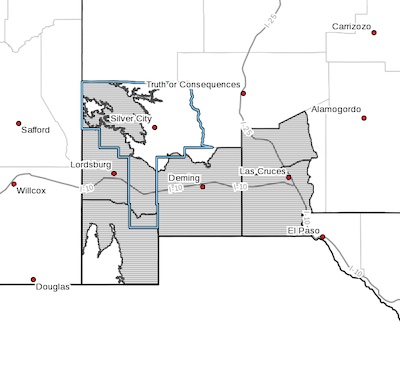
Extended through Monday: Heat Advisory 0804-080723
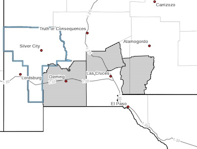 Southwest Desert/Mimbres Basin-Northern Dona Ana County-
Southern Tularosa Basin-
Including the cities of Deming, Columbus, Garfield, Hatch,
Radium Springs, Chaparral, Orogrande,
and White Sands Range Headquarters
312 PM MDT Wed Aug 2 2023
...HEAT ADVISORY IN EFFECT FROM 6 AM FRIDAY TO MIDNIGHT MDT
SUNDAY NIGHT...
CANCELED: Flood advisory 080223 - 2
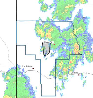 [Editor's Note: This only one of about five that the Beat has received. If you're in one of the thunderstorms or downstream from one, be aware, be careful.]
FLOOD ADVISORY IN EFFECT UNTIL 6 PM MDT THIS EVENING...
* WHAT...Flooding caused by excessive rainfall is expected.
* WHERE...A portion of southwest New Mexico, including the following
county, Grant.
*
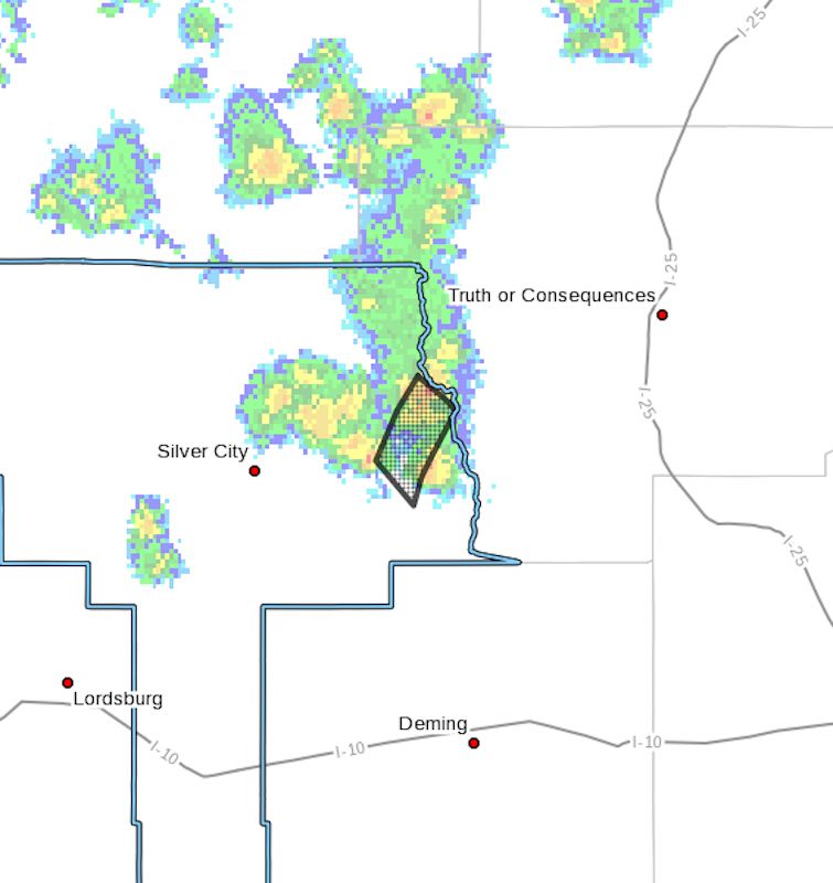
Flood Advisory 080223
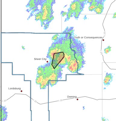 FLOOD ADVISORY IN EFFECT UNTIL 430 PM MDT THIS AFTERNOON...
* WHAT...Flooding caused by excessive rainfall is expected.
* WHERE...A portion of southwest New Mexico, including the following
county, Grant.
* WHEN...Until 430 PM MDT.
Flood Advisory 072723
 [Editor's Note: I receive these almost every day. Please, if it's raining upstream from where you are and you may be in danger, please use caution and common sense. I cannot post every one of them. Please be safe!)
Heat Advisory 0726-072723
 Southwest Desert/Mimbres Basin-Northern Dona Ana County-
Including the cities of Deming, Columbus, Garfield, Hatch,
and Radium Springs
225 PM MDT Sun Jul 23 2023
...HEAT ADVISORY IN EFFECT FROM NOON WEDNESDAY TO MIDNIGHT MDT
THURSDAY NIGHT...
* WHAT...Hot conditions expected. Afternoon highs of 104 to 106
degrees.
Lake Roberts Area Flooding 072223
ROAD ADVISORY
FAIR DRIVING CONDITIONS – Lake Roberts Area Flooding
NM 35 from milepost 25 to 27 (NM 15 intersection) has water running over the roadway, roadway is still passable. When the roadway is flooded do not cross and seek an alternate route. NMDOT is currently monitoring and will notify as conditions change.
Heat Advisory continues 0719-072123
 Upper Gila River Valley-Southwest Desert/Lower Gila River Valley-
Lowlands of the Bootheel-Southwest Desert/Mimbres Basin-
Northern Dona Ana County-Southern Dona Ana County/Mesilla Valley-
Including the cities of Cliff, Buckhorn, Gila Hot Springs,
Mule Creek, Lordsburg, Red Rock, Virden, Antelope Wells, Animas,
Hachita, Deming, Columbus, Garfield, Hatch, Radium Springs,
Las Cruces, Vado, and Sunland Park
127 AM MDT Wed Jul 19 2023
...HEAT ADVISORY NOW IN EFFECT UNTIL MIDNIGHT MDT FRIDAY NIGHT...
* WHAT...Hot conditions with temperatures of 104 to 108 degrees
expected.
* WHERE...Portions of south central and southwest New Mexico and
far west Texas.
* WHEN...Until midnight MDT Friday night.
* IMPACTS...Very hot temperatures will significantly increase
the potential for heat related illnesses, particularly for
those working or participating in outdoor activities.
* ADDITIONAL DETAILS...The hottest conditions will occur today and
Thursday.
PRECAUTIONARY/PREPAREDNESS ACTIONS...
Drink plenty of fluids, stay in an air-conditioned room, stay out
of the sun, and check up on relatives and neighbors. Young
children and pets should never be left unattended in vehicles
under any circumstances.
Take extra precautions if you work or spend time outside. When
possible reschedule strenuous activities to early morning or
evening. Know the signs and symptoms of heat exhaustion and heat
stroke. Wear lightweight and loose fitting clothing when
possible. To reduce risk during outdoor work, the Occupational
Safety and Health Administration recommends scheduling frequent
rest breaks in shaded or air conditioned environments. Anyone
overcome by heat should be moved to a cool and shaded location.
Heat stroke is an emergency! Call 9 1 1.