


Weather
Heat Advisory extended 0718-072023
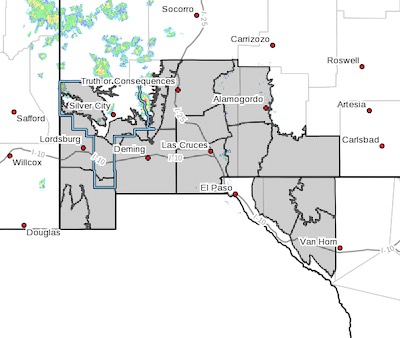 Upper Gila River Valley-Southern Gila Foothills/Mimbres Valley-
Southwest Desert/Lower Gila River Valley-Lowlands of the Bootheel-
Uplands of the Bootheel-Southwest Desert/Mimbres Basin-
Eastern Black Range Foothills-Sierra County Lakes-
Northern Dona Ana County-Southern Dona Ana County/Mesilla Valley-
Central Tularosa Basin-Southern Tularosa Basin-Otero Mesa-
Northern Hudspeth Highlands/Hueco Mountains-Salt Basin-
Southern Hudspeth Highlands-
Including the cities of Cliff, Buckhorn, Gila Hot Springs,
Heat advisory extended to Wednesday night midnight 071923
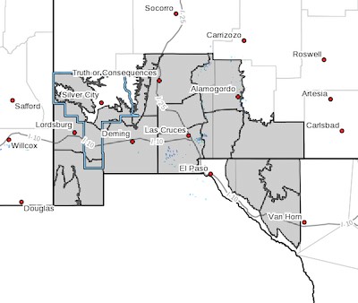 Upper Gila River Valley-Southern Gila Foothills/Mimbres Valley-
Southwest Desert/Lower Gila River Valley-Lowlands of the Bootheel-
Uplands of the Bootheel-Southwest Desert/Mimbres Basin-
Eastern Black Range Foothills-Sierra County Lakes-
Northern Dona Ana County-Southern Dona Ana County/Mesilla Valley-
Central Tularosa Basin-Southern Tularosa Basin-Otero Mesa-
Northern Hudspeth Highlands/Hueco Mountains-Salt Basin-
Southern Hudspeth Highlands-
Including the cities of Cliff, Buckhorn, Gila Hot Springs,
Mule Creek, Mimbres, Hurley, Faywood, Grant County Airport,
Lordsburg, Red Rock, Virden, Antelope Wells, Animas, Hachita,
Cloverdale, Deming, Columbus, Hillsboro, Winston,
Truth Or Consequences, Derry, Spaceport, Garfield, Hatch,
Radium Springs, Las Cruces, Vado, Sunland Park, Alamogordo,
Tularosa, White Sands National Park, Chaparral, Orogrande,
White Sands Range Headquarters, Crow Flats, Hueco Tanks,
Loma Linda, Cornudas, Dell City, Salt Flat, and Sierra Blanca
503 AM MDT Sun Jul 16 2023
Revised: Flood Advisory 071423
 [Editor's Note: The Beat has received at least six more flood advisories today. If it was pouring rain where you are or upstream from where you are, then watch out for flooding! My readers are smart. They understand these things. Be careful and wary, but don't expect a nanny state here!]
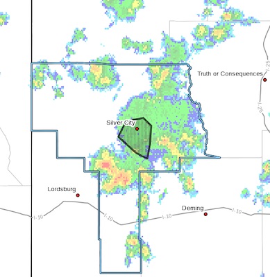
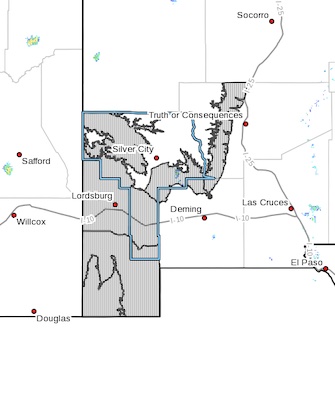
FLOOD ADVISORY IN EFFECT UNTIL 530 PM MDT THIS AFTERNOON...
* WHAT...Flooding caused by excessive rainfall is expected.
* WHERE...A portion of southwest New Mexico, including the following county, Grant.
* WHEN...Until 530 PM MDT.
* IMPACTS...Minor flooding in low-lying and poor drainage areas. Some low-water crossings may become impassable.
* ADDITIONAL DETAILS...
Flood Advisory 071323 - 4
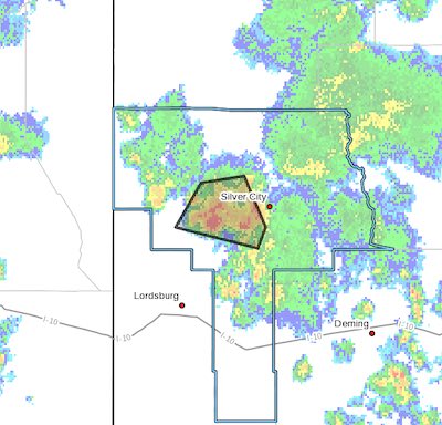 FLOOD ADVISORY IN EFFECT UNTIL 745 PM MDT THIS EVENING...
* WHAT...Arroyo and small stream flooding caused by excessive
rainfall is expected.
* WHERE...A portion of southwest New Mexico, including the following
county, Grant.
* WHEN...Until 745 PM MDT.
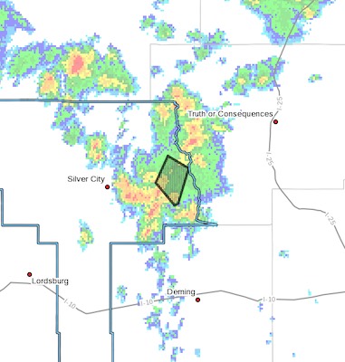
Flood Advisory 071323 - 3
 .FLOOD ADVISORY IN EFFECT UNTIL 645 PM MDT THIS EVENING...
* WHAT...Arroyo and small stream flooding caused by excessive
rainfall is expected.
* WHERE...A portion of southwest New Mexico, including the following
county, Grant.
* WHEN...Until 645 PM MDT.
Flood Advisory 071323 - 2
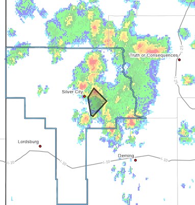 FLOOD ADVISORY IN EFFECT UNTIL 6 PM MDT THIS EVENING...
* WHAT...Arroyo and small stream flooding caused by excessive
rainfall is expected.
* WHERE...A portion of southwest New Mexico, including the following
county, Grant.
* WHEN...Until 600 PM MDT.
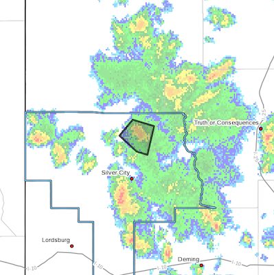
Flood advisory in eastern Grant County 071323
 ...FLOOD ADVISORY IN EFFECT UNTIL 430 PM MDT THIS AFTERNOON...
* WHAT...Arroyo and small stream flooding caused by excessive
rainfall is expected.
* WHERE...A portion of southwest New Mexico, including the following
county, Grant.
* WHEN...Until 430 PM MDT.
Heat Advisory 0715-071823
 Upper Gila River Valley-Southern Gila Foothills/Mimbres Valley-
Southwest Desert/Lower Gila River Valley-Lowlands of the Bootheel-
Uplands of the Bootheel-Eastern Black Range Foothills-
Including the cities of Cliff, Buckhorn, Gila Hot Springs,
Mule Creek, Mimbres, Hurley, Faywood, Grant County Airport, Lordsburg, Red Rock, Virden, Antelope Wells, Animas, Hachita, Cloverdale, Hillsboro, and Winston
617 AM MDT Thu Jul 13 2023