The Chronicles Of Grant County
Continental Divide
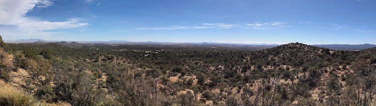 This was the view from Jack's Peak on the Continental Divide National Scenic Trail in the Gila National Forest in 2017. (The photograph was provided by Tony Perrie through Flickr.)
The Continental Divide goes through Grant County.
"The headwaters of our nation spring from the Continental Divide," according to a statement from the U S Forest Service. "Imagine a line running the entire length of North and South America, from the icy northern reaches of Canada to the Strait of Magellan at the southernmost tip of Chile. This line runs north to south along the very highest elevations of these continents, connecting the peaks of the Rocky Mountains with the Andes in South America."
The U S Forest Service indicated that "rain or snow that falls on these peaks will flow either to the east or to the west down the slopes of these mountain ranges. This flow begins as small trickles that join up to form streams, then swell into roaring rivers that provide nourishment to the land, plants, and animals."
The Continental Divide National Scenic Trail follows much of the Continental Divide, though the trail diverts from the actual Continental Divide in some areas. For much of its distance, "To walk along the trail is to have one foot in the watershed of the Atlantic Ocean and the other in the watershed of the Pacific," stated the U S Forest Service.
This specific trail, one of eleven national scenic trails in the United States, began taking shape "in 1978, [when the U S] Congress designated the Continental Divide National Scenic Trail...and made a monumental decision to secure the future of one of the most significant scenic, wild and remote landscapes in the United States," according to a statement from the Continental Divide Trail Coalition. "Stretching 3,100 miles from Canada to Mexico, the Continental Divide Scenic Trail provides a scenic, high-quality, primitive hiking and horseback riding experience along the backbone of the Rocky Mountains."
The Continental Divide Trail Coalition is a 501(c)3 non-profit organization that was founded in 2012. Its mission is "to complete, promote, and protect the Continental Divide National Scenic Trail." The organization indicated that it strives to build "a strong and diverse trail community, providing up-to-date information to the public, and encouraging conservation and stewardship of the trail, its corridor, and surrounding landscapes."
Silver City is one of sixteen communities in the Rocky Mountain states that have been designated a Gateway Community by the Continental Divide Trail Coalition. The designation of the county seat of Grant County as a Gateway Community was announced officially on April 23, 2014; Silver City was the first such Gateway Community designated by the Continental Divide Trail Coalition.
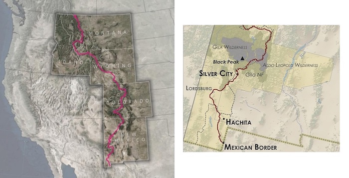 The Continental Divide National Scenic Trail is represented by the red line on both maps, while the Continental Divide is represented by the dotted black line on the map to the right. (The map to the left is a portion of a larger map provided courtesy of the U S Forest Service, while the map to the right is a portion of a larger map provided courtesy of the Continental Divide Trail Coalition.)
Do you have questions about communities in Grant County?
A street name? A building?
Your questions may be used in a future news column.
Contact Richard McDonough at chroniclesofgrantcounty@mail.com.
© 2020 Richard McDonough