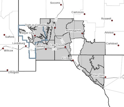
 Southern Gila Highlands/Black Range-
Southern Gila Foothills/Mimbres Valley-
Southwest Desert/Mimbres Basin-Eastern Black Range Foothills-
Sierra County Lakes-Northern Dona Ana County-
Southern Dona Ana County/Mesilla Valley-Central Tularosa Basin-
Otero Mesa-Western El Paso County-
Northern Hudspeth Highlands/Hueco Mountains-Salt Basin-
Southern Hudspeth Highlands-
Rio Grande Valley of Eastern El Paso/Western Hudspeth Counties-
Rio Grande Valley of Eastern Hudspeth County-
Including the cities of Silver City, Lake Roberts, Kingston,
Fort Bayard, Mimbres, Hurley, Faywood, Grant County Airport,
Deming, Columbus, Hillsboro, Winston, Truth Or Consequences,
Derry, Spaceport, Garfield, Hatch, Radium Springs, Las Cruces,
Vado, Sunland Park, Alamogordo, Tularosa, White Sands Monument,
Crow Flats, Downtown El Paso, West El Paso, Upper Valley,
Hueco Tanks, Loma Linda, Cornudas, Dell City, Salt Flat,
Sierra Blanca, Fabens, Fort Hancock, Tornillo,
and Indian Hot Springs
411 PM MDT Mon Mar 11 2019
...HIGH WIND WATCH IN EFFECT FROM WEDNESDAY MORNING THROUGH
WEDNESDAY EVENING...
The National Weather Service in El Paso Tx/Santa Teresa has
issued a High Wind Watch, which is in effect from Wednesday
morning through Wednesday evening.
* TIMING...Winds will be strong through the day on Tuesday and
diminish somewhat overnight. Winds will again increase and
become very windy during the day on Wednesday with the strongest
winds expected during the late morning and afternoon hours.
* WINDS...Westerly winds 20 to 30 mph Tuesday. Diminishing to 10
to 20 mph overnight Tuesday night. Winds increasing and becoming
stronger during the day on Wednesday with winds of 35 to 45 mph
with gusts 55 to 65 mph. Gaps, passes, and lee east slopes
could see gusts 70 to 80 mph.
* IMPACTS...Blowing dust likely Tuesday afternoon. Lesser dust on
Wednesday. Buffeting and gusty winds Tuesday will make for
difficult travel for higher-profile vehicles. Wednesday winds
may cause damage to structures and vegetation, cause power
outages, and overturn high profile vehicles on north to south
routes.
PRECAUTIONARY/PREPAREDNESS ACTIONS...
A High Wind Watch means there is the potential for a hazardous
high wind event. Sustained winds of at least 40 mph, or gusts of
58 mph or stronger may occur. Continue to monitor the latest
forecasts.