 New Mexico Fire Weather Zone 110
Southwest Mountains/gila Nf/apache Nf/glz-
New Mexico Fire Weather Zone 111
Southwest Deserts And Lowlands/las Cruces Blm/glz-
New Mexico Fire Weather Zone 112
South Central Lowlands And Southern Rio Grande Valley/blm/glz-
New Mexico Fire Weather Zone 113 Capitan And Sacramento Mountains/lincoln Nf/lnz-
123 Pm Mdt Mon Apr 8 2019
...Red Flag Warning In Effect From 2 Pm To 9 Pm MDT Tuesday For Strong Winds And Low Relative Humidities...
.Fire Weather Watch In Effect From Wednesday Morning Through Wednesday Evening For Strong Winds And Low Relative Humidities...
The National Weather Service in El Paso Tx/Santa Teresa has
issued a Red Flag Warning, which is in effect from 2 PM to 9 PM
MDT Tuesday. A Fire Weather Watch has also been issued. This Fire
Weather Watch is in effect from Wednesday morning through
Wednesday evening.
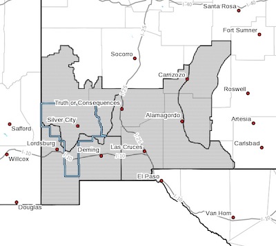
* AFFECTED AREA...Fire weather zone 110. Fire weather zone 111.
Fire weather zone 112. Fire weather zone 113.
* WIND...West to southwest winds will increase to 20 to 25 mph
with gusts to 35 mph on Tuesday. Winds will increase Wednesday
to 30 to 40 mph with gusts over 55 mph.
* HUMIDITY...6 to 12 percent both days.
* HIGHEST THREAT...is located west of the Rio Grande especially in
the late afternoon and early evening on Tuesday. On Wednesday,
areas east of the Continental Divide will have most extreme
conditions.
* IMPACTS...any fires that develop will likely spread rapidly.
Outdoor burning is not recommended.
PRECAUTIONARY/PREPAREDNESS ACTIONS...
A Red Flag Warning means that critical fire weather conditions
are either occurring now, or will shortly. A combination of
strong winds, low relative humidity, and warm temperatures can
contribute to extreme fire behavior.
A Fire Weather Watch means that critical fire weather conditions
are forecast to occur. Listen for later forecasts and possible
Red Flag Warnings.