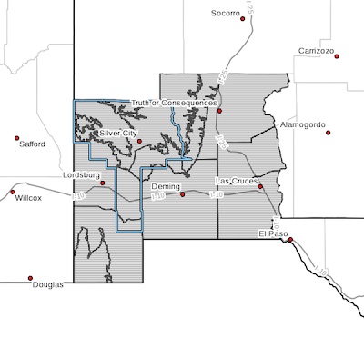
 Upper Gila River Valley-Southern Gila Highlands/Black Range-
Southern Gila Foothills/Mimbres Valley-
Southwest Desert/Lower Gila River Valley-Lowlands of the Bootheel-
Uplands of the Bootheel-Southwest Desert/Mimbres Basin-
Eastern Black Range Foothills-Sierra County Lakes-
Northern Dona Ana County-Southern Dona Ana County/Mesilla Valley-
Including the cities of Cliff, Buckhorn, Gila Hot Springs,
Mule Creek, Silver City, Lake Roberts, Kingston, Fort Bayard, Mimbres, Hurley, Faywood, Grant County Airport, Lordsburg, Red Rock, Virden, Antelope Wells, Animas, Hachita, Cloverdale, Deming, Columbus, Hillsboro, Winston, Truth Or Consequences, Derry, Spaceport, Garfield, Hatch, Radium Springs, Las Cruces, Vado, and Sunland Park
256 PM MST Thu Feb 11 2021
Upper level energy will bring the chance for accumulating snows
across the portions of the Gila mountains and Black Range, with
lesser amounts across the lowlands west of the Rio Grande.
The upper level energy will approach early to midday Sunday, with
rain showers across the lowlands, and a mix of rain and snow
across the Gila and Black range. Any mix of rain and snow will
quickly transition to mainly snow across the mountains, some
moderate at times. Moderate snowfall rates, combined with breezy
to windy conditions, especially Sunday afternoon, will cause
significant reductions in visibility, slick roads, and dangerous
driving conditions across these regions. Farther south across the
lowlands, rain may mix with snow at times late Sunday evening and
night, resulting in only minor accumulations.
As the rain/snow diminishes late Sunday evening and overnight,
total snow accumulations look to be on the order of 3 to 6 inches
across portions of the Gila and Black Range, and a trace to 2
inches elsewhere.
Sunday night temperatures will be cold, with teens to near 20
degrees most locations. Any standing water from rain will freeze
making for slick roadways and possible hazardous travel,
especially on bridges, overpasses, and elevated roadways.
Temperatures will rise into the 40s to near 50 degrees Monday
afternoon.
Continue to monitor the forecast for updates along with watches,
warning, and advisories. Travel impacts are likely.