


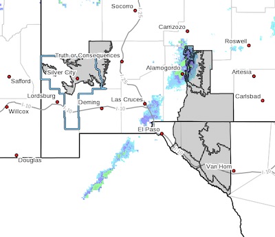
 A Winter Storm System brings significant amounts of snow to the Sacramento Mountains, the Otero Mesa, Hudspeth and the higher elevations of the Black Range... .A winter storm system is expected to move through southern New Mexico and far west Texas on Sunday. This system brings gusty winds and significant snowfall accumulations. Moderate to heavy snow is possible in those areas with 6 to 12 inches in the Sacramento Mountains, 5 to 8 inches in the Black Range above 7000 feet, and 3 to 6 inches in Hudspeth and the Otero Mesa. The rest of the lowlands will see light to moderate snowfall with amounts below 3 inches through Monday morning.
Southern Gila Highlands/Black Range-
West Slopes Sacramento Mountains Below 7500 Feet-
Sacramento Mountains Above 7500 Feet-
East Slopes Sacramento Mountains Below 7500 Feet-Otero Mesa-
Northern Hudspeth Highlands/Hueco Mountains-Salt Basin-
Southern Hudspeth Highlands-
Rio Grande Valley of Eastern El Paso/Western Hudspeth Counties-
Rio Grande Valley of Eastern Hudspeth County-
Including the cities of Silver City, Lake Roberts, Mescalero,
Timberon, Cloudcroft, Mayhill, Pinon, Sacramento, Crow Flats,
Hueco Tanks, Cornudas, Dell City, Salt Flat, Sierra Blanca,
Fabens, Fort Hancock, and Tornillo
208 PM MST Fri Feb 12 2021
...WINTER STORM WATCH IN EFFECT FROM SATURDAY EVENING THROUGH
LATE SUNDAY NIGHT...
* WHAT...Heavy snow expected. Total snow accumulations of 6 to 12
inches over the Sacramento Mountains, 5 to 8 inches over the
Black Range, and 3 to 6 inches over Hudspeth county and the
Otero Mesa. Winds could gust as high as 45 mph.
* WHERE...The Sacramento Mountains, the Otero Mesa, and the higher
elevations of the Gila region and the Black Range above 7000
feet in New Mexico. Also Hudspeth county in far west Texas.
* WHEN...From 11 PM Saturday evening through 5 AM Monday morning.
* ADDITIONAL DETAILS...Most of the snow accumulation is expected
on Sunday between 6 AM and 6 PM. Gusty winds may lead to
blowing snow and whiteout conditions at times.
PRECAUTIONARY/PREPAREDNESS ACTIONS...
Roads will become snow covered and potentially impassable in some
places. Avoid travel if possible, but keep an extra flashlight,
food, and water in your vehicle in case of an emergency if you
must travel. The latest road conditions for the state you are
calling from can be obtained by calling 5 1 1. Monitor the latest
forecasts for updates on this situation.