 Critical Fire Weather Conditions Expected Wednesday and Thursday Afternoons... .Southwesterly winds will increase and combine with very low relative humidity values to create critical fire weather conditions Wednesday afternoon in the Gila Region and the lowlands of southwestern and New Mexico. Winds will increase by early Wednesday afternoon and peak around 20 to 30 mph. At the same time, minimum relative humidities will fall to 8 to 10 percent. Winds will subside by Wednesday evening, only to return area wide on Thursday as critical fire weather conditions expand in coverage.
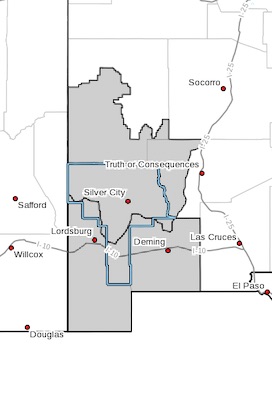
NEW MEXICO FIRE WEATHER ZONE 110
SOUTHWEST MOUNTAINS/GILA NF/APACHE NF/GLZ-
NEW MEXICO FIRE WEATHER ZONE 111
SOUTHWEST DESERTS AND LOWLANDS/LAS CRUCES BLM/GLZ-
1225 PM MDT Tue Apr 20 2021
THIS AFTERNOON RED FLAG WARNING REMAINS IN EFFECT UNTIL 9 PM
MDT THIS EVENING FOR STRONG WINDS AND VERY LOW RELATIVE HUMIDITY
FOR FIRE WEATHER ZONES 110 AND 111...
...THURSDAY RED FLAG WARNING IN EFFECT FROM NOON TO 9 PM MDT
FOR STRONG WINDS AND VERY LOW RELATIVE HUMIDITY FOR FIRE WEATHER
ZONES 110 AND 111...
The National Weather Service in El Paso Tx/Santa Teresa has
issued a Red Flag Warning, which is in effect from noon to 9 PM
MDT Thursday. The Fire Weather Watch is no longer in effect.
* AFFECTED AREA...Fire weather zones 110 and 111 in southwestern
New Mexico. This includes portions of the Gila, Blacks, and
southwest deserts of southwest New Mexico.
* WIND...Southwest winds 20 to 30 mph with gusts up to 40 mph.
* HUMIDITY...7 to 12 percent.
* IMPACTS...Any fires that develop will likely spread rapidly.
Outdoor burning is not recommended.
PRECAUTIONARY/PREPAREDNESS ACTIONS...
A Red Flag Warning means that critical fire weather conditions
are either occurring now, or will shortly. A combination of
strong winds, low relative humidity, and