 Upper Gila River Valley-Southern Gila Highlands/Black Range-Southern
Gila Foothills/Mimbres Valley-Southwest Desert/Mimbres Basin-Eastern
Black Range Foothills-Sierra County Lakes-Northern Dona Ana County-
Southern Dona Ana County/Mesilla Valley-Central Tularosa Basin-
Southern Tularosa Basin-Western El Paso County-Eastern/Central El
Paso County-Northern Hudspeth Highlands/Hueco Mountains-Southern
Hudspeth Highlands-Rio Grande Valley of Eastern El Paso/Western
Hudspeth Counties-Rio Grande Valley of Eastern Hudspeth County-
Including the cities of Indian Hot Springs, Spaceport, Winston, Gila
Hot Springs, Derry, Sierra Blanca, Sunland Park, Vado, Fort Bayard,
Alamogordo, Fabens, Fort Bliss, Hatch, Truth Or Consequences,
Columbus, Lake Roberts, Hillsboro, West El Paso, Socorro, Upper
Valley, Cliff, Grant County Airport, East and Northeast El Paso,
Loma Linda, Hurley, Chaparral, Tularosa, Faywood, White Sands Range
Headquarters, Buckhorn, Mimbres, Las Cruces, White Sands National
Park, Hueco Tanks, Fort Hancock, Kingston, Deming, Silver City,
Garfield, Mule Creek, Orogrande, Radium Springs, Tornillo, and
Downtown El Paso
1206 AM MDT Mon Jun 28 2021
...FLASH FLOOD WATCH IN EFFECT THROUGH TUESDAY MORNING...
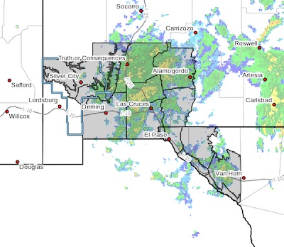
The National Weather Service in El Paso Tx/Santa Teresa has expanded
the
* Flash Flood Watch to include portions of New Mexico and southwest
Texas, including the following areas, in New Mexico, Central
Tularosa Basin, Eastern Black Range Foothills, Northern Dona Ana
County, Sierra County Lakes, Southern Dona Ana County/Mesilla
Valley, Southern Gila Foothills/Mimbres Valley, Southern Gila
Highlands/Black Range, Southern Tularosa Basin, Southwest
Desert/Mimbres Basin and Upper Gila River Valley. In southwest
Texas, Eastern/Central El Paso County, Northern Hudspeth
Highlands/Hueco Mountains, Rio Grande Valley of Eastern El
Paso/Western Hudspeth Counties, Rio Grande Valley of Eastern
Hudspeth County, Southern Hudspeth Highlands and Western El Paso
County.
* Through late tonight
* Thunderstorms will continue to develop through Tuesday morning. An
additional 1 to 3 inches of rain is possible over these areas, and
as much as 5 inches could fall in a few places. Areas near recent
burn scars are particularly sensitive to flash flooding.
PRECAUTIONARY/PREPAREDNESS ACTIONS...
A Flash Flood Watch means that conditions may develop that lead to
Flash Flooding. Flash Flooding is a very dangerous situation. You
should monitor later forecasts and be prepared to take action should
Flash Flood Warnings be issued.
Do not enter or cross flowing water or water of unknown depth.
Stay away or be swept away. River banks and culverts can become
unstable and unsafe.