 Southern Gila Highlands/Black Range-Southern Gila Foothills/Mimbres
Valley-Southwest Desert/Mimbres Basin-Eastern Black Range Foothills-
Sierra County Lakes-Northern Dona Ana County-Southern Dona Ana
County/Mesilla Valley-Central Tularosa Basin-Southern Tularosa Basin-
West Slopes Sacramento Mountains Below 7500 Feet-Sacramento
Mountains Above 7500 Feet-East Slopes Sacramento Mountains Below
7500 Feet-Otero Mesa-Western El Paso County-Eastern/Central El Paso
County-Northern Hudspeth Highlands/Hueco Mountains-Salt Basin-
Southern Hudspeth Highlands-Rio Grande Valley of Eastern El
Paso/Western Hudspeth Counties-Rio Grande Valley of Eastern Hudspeth
County-
Including the cities of
Indian Hot Springs, Spaceport, Winston,
Cornudas, Derry, Sierra Blanca, Sunland Park, Vado, Fort Bayard,
Alamogordo, Cloudcroft, Mescalero, Hatch, Fabens, Truth Or
Consequences, Apache Summit, Columbus, Salt Flat, Mayhill, Lake
Roberts, Sacramento, Timberon, Sunspot, Hillsboro, West El Paso,
Socorro, Mountain Park, Grant County Airport, East and Northeast El
Paso, Dell City, Loma Linda, Hurley, Chaparral, Tularosa, Fort
Bliss, Faywood, White Sands Range Headquarters, Crow Flats, Mimbres,
Las Cruces, White Sands National Park, Hueco Tanks, Pinon, Fort
Hancock, Kingston, Deming, Silver City, Garfield, Upper Valley,
Orogrande, Radium Springs, Tornillo, and Downtown El Paso
227 AM MDT Wed Jun 30 2021
...FLASH FLOOD WATCH NOW IN EFFECT THROUGH THIS EVENING...
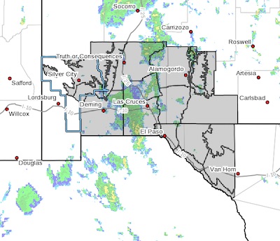
The Flash Flood Watch is now in effect for
* Portions of New Mexico and southwest Texas, including the
following areas, in New Mexico, Central Tularosa Basin, East
Slopes Sacramento Mountains Below 7500 Feet, Eastern Black Range
Foothills, Northern Dona Ana County, Otero Mesa, Sacramento
Mountains Above 7500 Feet, Sierra County Lakes, Southern Dona Ana
County/Mesilla Valley, Southern Gila Foothills/Mimbres Valley,
Southern Gila Highlands/Black Range, Southern Tularosa Basin,
Southwest Desert/Mimbres Basin and West Slopes Sacramento
Mountains Below 7500 Feet. In southwest Texas, Eastern/Central El
Paso County, Northern Hudspeth Highlands/Hueco Mountains, Rio
Grande Valley of Eastern El Paso/Western Hudspeth Counties, Rio
Grande Valley of Eastern Hudspeth County, Salt Basin, Southern
Hudspeth Highlands and Western El Paso County.
* Through this evening
* Additional showers and thunderstorms are possible across areas
where the soil is saturated. As a result any significant rainfall
across these areas could lead to additional flash flooding today
and this evening.
PRECAUTIONARY/PREPAREDNESS ACTIONS...
A Flash Flood Watch means that conditions may develop that lead to
Flash Flooding. Flash Flooding is a very dangerous situation. You
should monitor later forecasts and be prepared to take action should
Flash Flood Warnings be issued.
Do not enter or cross flowing water or water of unknown depth.
Stay away or be swept away. River banks and culverts can become
unstable and unsafe.