 Upper Gila River Valley-Southern Gila Highlands/Black Range-Southern
Gila Foothills/Mimbres Valley-Eastern Black Range Foothills-West
Slopes Sacramento Mountains Below 7500 Feet-Sacramento Mountains
Above 7500 Feet-East Slopes Sacramento Mountains Below 7500 Feet-
Including the cities of Kingston, Gila Hot Springs, Fort Bayard,
Cloudcroft, Hillsboro, Apache Summit, Mayhill, Lake Roberts,
Sacramento, Timberon, Sunspot, Mountain Park, Winston, Cliff, Grant
County Airport, Hurley, Faywood, Buckhorn, Mimbres, Pinon, Silver
City, Mule Creek, and Mescalero
233 AM MDT Fri Jul 2 2021
...FLOOD WATCH IN EFFECT FROM NOON MDT TODAY THROUGH THIS EVENING...
The National Weather Service in El Paso Tx/Santa Teresa has issued a
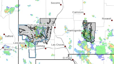
* Flood Watch for portions of south central New Mexico and southwest
New Mexico, including the following areas, in south central New
Mexico, East Slopes Sacramento Mountains Below 7500 Feet,
Sacramento Mountains Above 7500 Feet and West Slopes Sacramento
Mountains Below 7500 Feet. In southwest New Mexico, Eastern Black
Range Foothills, Southern Gila Foothills/Mimbres Valley, Southern
Gila Highlands/Black Range and Upper Gila River Valley.
* From Noon MDT today through this evening
* Thunderstorms are likely this afternoon and evening over the
Sacramento Mountains, Black Range and Gila Wilderness. Heavy rain
will be possible with these slow moving storms. In many places the
soil is saturated and any additional rainfall could very quickly
lead to flash flooding.
* Areas that have already received heavy rainfall will be
particularly prone to flash flooding. In addition, locations below
recent burn scars will also be prone to flash flooding.
PRECAUTIONARY/PREPAREDNESS ACTIONS...
A Flood Watch means there is a potential for flooding based on
current forecasts. You should monitor later forecasts and be alert
for possible flood warnings. Those living in areas prone to flooding
should be prepared to take action should flooding develop.