 HEAVY RAIN THREAT EXPECTED FOR SOUTHWEST NEW MEXICO FRIDAY INTO THIS WEEKEND... An approaching low pressure system from the east will usher in additional moisture across much of eastern Arizona and southwest New Mexico this weekend and allow for widespread showers and thunderstorms through much of Friday and Saturday. Locally heavy rainfall will cause flooding to occur across much of the Gila Wilderness and NM Bootheel, along with isolated flooding across the desert lowlands and I-10 corridor between the AZ state line and Deming.
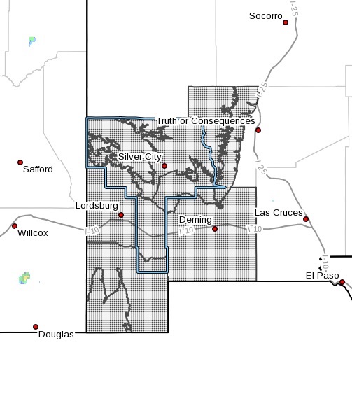
Upper Gila River Valley-Southern Gila Highlands/Black Range-Southern
Gila Foothills/Mimbres Valley-Southwest Desert/Lower Gila River
Valley-Lowlands of the Bootheel-Uplands of the Bootheel-Southwest
Desert/Mimbres Basin-Eastern Black Range Foothills-
Including the cities of Winston, Gila Hot Springs, Animas, Antelope
Wells, Fort Bayard, Hillsboro, Virden, Cloverdale, Columbus, Lake
Roberts, Cliff, Grant County Airport, Hurley, Faywood, Buckhorn,
Mimbres, Lordsburg, Kingston, Deming, Silver City, Mule Creek, Red
Rock, and Hachita
1228 PM MDT Wed Jul 21 2021
...FLASH FLOOD WATCH IN EFFECT FROM FRIDAY MORNING THROUGH LATE
SATURDAY NIGHT...
The National Weather Service in El Paso Tx/Santa Teresa has issued a
* Flash Flood Watch for a portion of southwest New Mexico, including
the following areas, Eastern Black Range Foothills, Lowlands of
the Bootheel, Southern Gila Foothills/Mimbres Valley, Southern
Gila Highlands/Black Range, Southwest Desert/Lower Gila River
Valley, Southwest Desert/Mimbres Basin, Uplands of the Bootheel
and Upper Gila River Valley.
* From Friday morning through late Saturday night.
* Rainfall amounts will range from 1 to 2 inches over a two-day
period, with locally higher amounts due to thunderstorms.
Additional flooding may occur over wildfire burn scars due to the
lack of moisture retention.
PRECAUTIONARY/PREPAREDNESS ACTIONS...
You should monitor later forecasts and be prepared to take action
should Flash Flood Warnings be issued.