 Upper Gila River Valley-Southern Gila Highlands/Black Range-
Southern Gila Foothills/Mimbres Valley-
Southwest Desert/Lower Gila River Valley-Lowlands of the Bootheel-
Uplands of the Bootheel-Southwest Desert/Mimbres Basin-
Eastern Black Range Foothills-Sierra County Lakes-
Northern Dona Ana County-Southern Dona Ana County/Mesilla Valley-
Central Tularosa Basin-Southern Tularosa Basin-
West Slopes Sacramento Mountains Below 7500 Feet-
Sacramento Mountains Above 7500 Feet-
East Slopes Sacramento Mountains Below 7500 Feet-Otero Mesa-
Western El Paso County-Eastern/Central El Paso County-
Northern Hudspeth Highlands/Hueco Mountains-Salt Basin-
Southern Hudspeth Highlands-
Rio Grande Valley of Eastern El Paso/Western Hudspeth Counties-
Rio Grande Valley of Eastern Hudspeth County-
Including the cities of Cliff, Buckhorn, Gila Hot Springs,
Mule Creek, Silver City, Lake Roberts, Kingston, Fort Bayard,
Mimbres, Hurley, Faywood, Grant County Airport, Lordsburg,
Red Rock, Virden, Antelope Wells, Animas, Hachita, Cloverdale,
Deming, Columbus, Hillsboro, Winston, Truth Or Consequences,
Derry, Spaceport, Garfield, Hatch, Radium Springs, Las Cruces,
Vado, Sunland Park, Alamogordo, Tularosa,
White Sands National Park, Chaparral, Orogrande,
White Sands Range Headquarters, Mescalero, Timberon,
Mountain Park, Cloudcroft, Sunspot, Apache Summit, Mayhill,
Pinon, Sacramento, Crow Flats, Downtown El Paso, West El Paso,
Upper Valley, East and Northeast El Paso, Socorro, Fort Bliss,
Hueco Tanks, Loma Linda, Cornudas, Dell City, Salt Flat,
Sierra Blanca, Fabens, Fort Hancock, Tornillo,
and Indian Hot Springs
155 PM MDT Wed Aug 11 2021
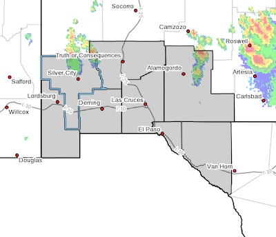
...LOCALLY HEAVY RAIN AND FLASH FLOODING POSSIBLE...
Moisture will continue to increase while a very slow moving
disturbance moves out of Mexico. This will lead to an increase in
thunderstorm coverage through at least Friday and possibly
Saturday. Storms will be capable of very heavy rainfall rates with
little motion, and thus flash flooding is a concern. Rainfall
rates will vary from location to location with some people
receiving little to none while others may receive totals in
excess of 3 inches. There still is uncertainty on which locations
will have the greatest risk for heavy rainfall and flash
flooding. Be aware of changing weather conditions and the
possibility of watches, advisories, and warnings. If you come
across a flooded roadway, TURN AROUND. DON'T DROWN.