 Abundant moisture will combine with a weak upper level trough to produce numerous showers and thunderstorms across the region again through Sunday afternoon. These thunderstorms will be very efficient rain producers and they will be slow moving. In addition, many locations have already had heavy rain leading to saturated ground. This combination will lead a continued threat for flash flooding.
Upper Gila River Valley-Southern Gila Highlands/Black Range-
Southern Gila Foothills/Mimbres Valley-
Southwest Desert/Lower Gila River Valley-Lowlands of the Bootheel-
Uplands of the Bootheel-Southwest Desert/Mimbres Basin-
Eastern Black Range Foothills-Sierra County Lakes-
Northern Dona Ana County-Southern Dona Ana County/Mesilla Valley-
Central Tularosa Basin-Southern Tularosa Basin-
West Slopes Sacramento Mountains Below 7500 Feet-
Sacramento Mountains Above 7500 Feet-
East Slopes Sacramento Mountains Below 7500 Feet-Otero Mesa-
Western El Paso County-Eastern/Central El Paso County-
Northern Hudspeth Highlands/Hueco Mountains-Salt Basin-
Southern Hudspeth Highlands-
Rio Grande Valley of Eastern El Paso/Western Hudspeth Counties-
Rio Grande Valley of Eastern Hudspeth County-
Including the cities of Cliff, Buckhorn, Gila Hot Springs,
Mule Creek, Silver City, Lake Roberts, Kingston, Fort Bayard,
Mimbres, Hurley, Faywood, Grant County Airport, Lordsburg,
Red Rock, Virden, Antelope Wells, Animas, Hachita, Cloverdale,
Deming, Columbus, Hillsboro, Winston, Truth Or Consequences,
Derry, Spaceport, Garfield, Hatch, Radium Springs, Las Cruces,
Vado, Sunland Park, Alamogordo, Tularosa,
White Sands National Park, Chaparral, Orogrande,
White Sands Range Headquarters, Mescalero, Timberon,
Mountain Park, Cloudcroft, Sunspot, Apache Summit, Mayhill,
Pinon, Sacramento, Crow Flats, Downtown El Paso, West El Paso,
Upper Valley, East and Northeast El Paso, Socorro, Fort Bliss,
Hueco Tanks, Loma Linda, Cornudas, Dell City, Salt Flat,
Sierra Blanca, Fabens, Fort Hancock, Tornillo,
and Indian Hot Springs
232 PM MDT Sat Aug 14 2021
...FLASH FLOOD WATCH NOW IN EFFECT THROUGH SUNDAY AFTERNOON...
The Flash Flood Watch is now in effect for
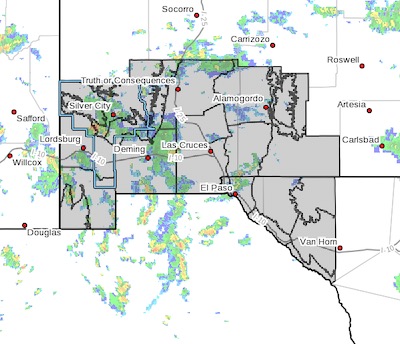
* Portions of New Mexico and southwest Texas, including the
following areas, in New Mexico, Central Tularosa Basin, East
Slopes Sacramento Mountains Below 7500 Feet, Eastern Black
Range Foothills, Lowlands of the Bootheel, Northern Dona Ana
County, Otero Mesa, Sacramento Mountains Above 7500 Feet,
Sierra County Lakes, Southern Dona Ana County/Mesilla Valley,
Southern Gila Foothills/Mimbres Valley, Southern Gila
Highlands/Black Range, Southern Tularosa Basin, Southwest
Desert/Lower Gila River Valley, Southwest Desert/Mimbres
Basin, Uplands of the Bootheel, Upper Gila River Valley, and
West Slopes Sacramento Mountains Below 7500 Feet. In southwest
Texas, Eastern/Central El Paso County, Northern Hudspeth
Highlands/Hueco Mountains, Rio Grande Valley of Eastern El
Paso/Western Hudspeth Counties, Rio Grande Valley of Eastern
Hudspeth County, Salt Basin, Southern Hudspeth Highlands, and
Western El Paso County.
* Through Sunday afternoon
* Abundant moisture will help fuel scattered to numerous
thunderstorms through Sunday afternoon. These thunderstorms will
be capable of producing very heavy rain in a brief amount of
time. Widespread storm totals of 1 to 4 inches with isolated
heavier amounts will be possible.
* Flooding of low water crossings will be likely. Flooding of
residences and other property near flood prone areas will be
possible. Remember, turn around don't drown.
PRECAUTIONARY/PREPAREDNESS ACTIONS...
You should monitor later forecasts and be prepared to take action
should Flash Flood Warnings be issued.