 WE WILL SEE ELEVATED FIRE WEATHER CONCERNS TODAY BECUASE OF STRONG WINDS AND VERY LOW HUMIDITY... .The upper level storm system that brought us critical fire weather conditions with strong winds yesterday has moved east of the area. Drier air has pushed into the region on the back side of the storm system and we will continue to be breezy to windy this afternoon. Some locations in area mountains and in southcentral New Mexico will reach Red Flag conditions this afternoon. Our winds will slow tonight, but the very dry airmass will remain in place through the coming weekend.
RED FLAG WARNING IN EFFECT FROM 10 AM THIS MORNING TO 8 PM MDTTHIS EVENING FOR STRONG WINDS AND LOW RELATIVE HUMIDITIES FOR
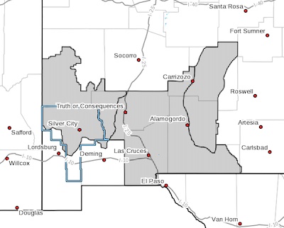
FIRE WEATHER ZONES 110, 112, AND 113...
The National Weather Service in El Paso Tx/Santa Teresa has
issued a Red Flag Warning, which is in effect from 10 AM this
morning to 8 PM MDT this evening.
* AFFECTED AREA...Fire weather zones 110, 112, and 113.
* WIND...West winds to 20 to 30 mph with gusts to 40 mph
* HUMIDITY...5 to 10%
* IMPACTS...any fires that develop will likely spread rapidly.
Outdoor burning is not recommended. Be careful with anything
that might cause sparks.
PRECAUTIONARY/PREPAREDNESS ACTIONS...
A Red Flag Warning means that critical fire weather conditions
are either occurring now, or will shortly. A combination of
strong winds, low relative humidity, and warm temperatures can
contribute to extreme fire behavior.