CRITICAL FIRE WEATHER FOR TODAY AND WEDNESDAY DUE TO EXTREMELY LOW HUMIDITY AND STRONG WINDS... .Extremely low humidity and above normal temperatures continue for both today and Wednesday. On both days, the winds will be from the west between 20 to 25 mph. For today, the strongest winds will be along and west of the Rio Grande. These winds combined with single digit relative humidity will lead to a high fire danger. Winds will be slightly stronger on Wednesday area wide with more sunshine.
153 PM MDT Tue Apr 19 2022
RED FLAG WARNING REMAINS IN EFFECT UNTIL 8 PM MDT THIS EVENING
FOR STRONG WINDS AND LOW HUMIDITY FOR FIRE WEATHER ZONES 110,
111, AND 112...
RED FLAG WARNING NOW IN EFFECT FROM NOON TO 8 PM MDT WEDNESDAY
FOR STRONG WINDS AND LOW HUMIDITY FOR FIRE WEATHER ZONES 110,
111, AND 112...
The National Weather Service in El Paso TX/Santa Teresa has
issued a Red Flag Warning, which is in effect from noon to 8 PM
MDT Wednesday. The Fire Weather Watch is no longer in effect.
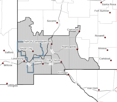
* AFFECTED AREA...Fire weather zone 110. Fire weather zone 111.
Fire weather zone 112.
* WIND... 20 to 25 mph with gusts up to 30 mph.
* HUMIDITY... 6 to 11 percent
* IMPACTS...any fires that develop will likely spread rapidly.
Outdoor burning is not recommended.
PRECAUTIONARY/PREPAREDNESS ACTIONS...
A Red Flag Warning means that critical fire weather conditions
are either occurring now, or will shortly. A combination of
strong winds, low relative humidity, and warm temperatures can
contribute to extreme fire behavior.
A Red Flag Warning means that critical fire weather conditions
are either occurring now, or will shortly. A combination of
strong winds, low relative humidity, and warm temperatures can
contribute to extreme fire behavior.
A Fire Weather Watch means that critical fire weather conditions
are forecast to occur. Listen for later forecasts and possible
Red Flag Warnings.