


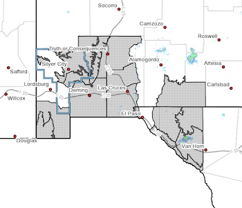
 Southern Gila Highlands/Black Range-
Southern Gila Foothills/Mimbres Valley-Lowlands of the Bootheel-
Uplands of the Bootheel-Southwest Desert/Mimbres Basin-
Eastern Black Range Foothills-Sierra County Lakes-
Northern Dona Ana County-Southern Dona Ana County/Mesilla Valley-
Otero Mesa-Western El Paso County-
Northern Hudspeth Highlands/Hueco Mountains-Salt Basin-
Southern Hudspeth Highlands-
Rio Grande Valley of Eastern El Paso/Western Hudspeth Counties-
Rio Grande Valley of Eastern Hudspeth County-
Including the cities of Silver City, Lake Roberts, Kingston,
Fort Bayard, Mimbres, Hurley, Faywood, Grant County Airport,
Antelope Wells, Animas, Hachita, Cloverdale, Deming, Columbus,
Hillsboro, Winston, Truth Or Consequences, Derry, Spaceport,
Garfield, Hatch, Radium Springs, Las Cruces, Vado, Sunland Park,
Crow Flats, Downtown El Paso, West El Paso, Upper Valley,
Hueco Tanks, Loma Linda, Cornudas, Dell City, Salt Flat,
Sierra Blanca, Fabens, Fort Hancock, Tornillo,
and Indian Hot Springs
213 AM MST Sun Feb 12 2023
...WIND ADVISORY IN EFFECT FROM NOON TO 8 PM MST MONDAY...
* WHAT...Southwest winds 25 to 35 mph with gusts up to 50 mph
possible.
* WHERE...Portions of south central and southwest New Mexico and
southwest Texas.
* WHEN...From noon to 8 PM MST Monday.
* IMPACTS...Gusty winds could blow around unsecured objects.
Tree limbs could be blown down and a few power outages may
result.
* ADDITIONAL DETAILS...Eastern slopes of mountains may see
stronger gusts. Winds remain breezy through Monday night.
PRECAUTIONARY/PREPAREDNESS ACTIONS...
Use extra caution when driving, especially if operating a high
profile vehicle. Secure outdoor objects.