high wind warning 0214 021523
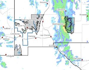
Southern Gila Highlands/Black Range-Uplands of the Bootheel-
Eastern Black Range Foothills-
West Slopes Sacramento Mountains Below 7500 Feet-
Sacramento Mountains Above 7500 Feet-
East Slopes Sacramento Mountains Below 7500 Feet-
Including the cities of Silver City, Lake Roberts, Kingston,
Fort Bayard, Cloverdale, Hillsboro, Winston, Mescalero, Timberon,
Mountain Park, Cloudcroft, Sunspot, Apache Summit, Mayhill,
Pinon, and Sacramento
158 PM MST Mon Feb 13 2023

...WIND ADVISORY NOW IN EFFECT UNTIL 3 AM MST TUESDAY...
...HIGH WIND WARNING IN EFFECT FROM 3 AM TUESDAY TO 5 PM MST
WEDNESDAY...

* WHAT...For the High Wind Warning, west winds 35 to 45 mph with
gusts up to 70 mph expected. For the Wind Advisory, southwest
winds 25 to 35 mph with gusts up to 50 mph.

* WHERE...Southern Gila Highlands/Black Range, Uplands of the
Bootheel, Eastern Black Range Foothills, West Slopes
Sacramento Mountains Below 7500 Feet, Sacramento Mountains
Above 7500 Feet and East Slopes Sacramento Mountains Below
7500 Feet Counties.

* WHEN...For the High Wind Warning, from 3 AM Tuesday to 5 PM MST
Wednesday. For the Wind Advisory, now until 3 AM MST Tuesday.

* IMPACTS...Damaging winds will blow down trees and power lines.
Widespread power outages are expected. Travel will be
difficult, especially for high profile vehicles.

* ADDITIONAL DETAILS...Strongest winds for the higher terrain of
the Gila Region and NM Bootheel will be seen Tuesday night
through early Wednesday morning. Strongest winds for the
Sacramento Mountains will be seen Wednesday morning thru
Wednesday afternoon. There will be occasional reductions in
wind speed, as this is a longer duration event.

PRECAUTIONARY/PREPAREDNESS ACTIONS...

People should avoid being outside in forested areas and around
trees and branches. If possible, remain in the lower levels of
your home during the windstorm, and avoid windows. Use caution if
you must drive.

Content on the Beat

WARNING: All articles and photos with a byline or photo credit are copyrighted to the author or photographer. You may not use any information found within the articles without asking permission AND giving attribution to the source. Photos can be requested and may incur a nominal fee for use personally or commercially.

Disclaimer: If you find errors in articles not written by the Beat team but sent to us from other content providers, please contact the writer, not the Beat. For example, obituaries are always provided by the funeral home or a family member. We can fix errors, but please give details on where the error is so we can find it. News releases from government and non-profit entities are posted generally without change, except for legal notices, which incur a small charge.

NOTE: If an article does not have a byline, it was written by someone not affiliated with the Beat and then sent to the Beat for posting.

Images: We have received complaints about large images blocking parts of other articles. If you encounter this problem, click on the title of the article you want to read and it will take you to that article's page, which shows only that article without any intruders. 

New Columnists: The Beat continues to bring you new columnists. And check out the old faithfuls who continue to provide content.

Newsletter: If you opt in to the Join GCB Three Times Weekly Updates option above this to the right, you will be subscribed to email notifications with links to recently posted articles.

Submitting to the Beat

Those new to providing news releases to the Beat are asked to please check out submission guidelines at https://www.grantcountybeat.com/about/submissions. They are for your information to make life easier on the readers, as well as for the editor.

Advertising: Don't forget to tell advertisers that you saw their ads on the Beat.

Classifieds: We have changed Classifieds to a simpler option. Check periodically to see if any new ones have popped up. Send your information to editor@grantcountybeat.com and we will post it as soon as we can. Instructions and prices are on the page.

Editor's Notes

It has come to this editor's attention that people are sending information to the Grant County Beat Facebook page. Please be aware that the editor does not regularly monitor the page. If you have items you want to send to the editor, please send them to editor@grantcountybeat.com. Thanks!

Here for YOU: Consider the Beat your DAILY newspaper for up-to-date information about Grant County. It's at your fingertips! One Click to Local News. Thanks for your support for and your readership of Grant County's online news source—www.grantcountybeat.com

Feel free to notify editor@grantcountybeat.com if you notice any technical problems on the site. Your convenience is my desire for the Beat.  The Beat totally appreciates its readers and subscribers!  

Compliance: Because you are an esteemed member of The Grant County Beat readership, be assured that we at the Beat continue to do everything we can to be in full compliance with GDPR and pertinent US law, so that the information you have chosen to give to us cannot be compromised.