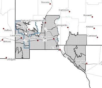
 Upper Gila River Valley-Southern Gila Foothills/Mimbres Valley-
Southwest Desert/Lower Gila River Valley-Lowlands of the Bootheel-
Uplands of the Bootheel-Southwest Desert/Mimbres Basin-
Sierra County Lakes-Northern Dona Ana County-
Southern Dona Ana County/Mesilla Valley-Otero Mesa-
Western El Paso County-
Northern Hudspeth Highlands/Hueco Mountains-Salt Basin-
Southern Hudspeth Highlands-
Rio Grande Valley of Eastern El Paso/Western Hudspeth Counties-
Rio Grande Valley of Eastern Hudspeth County-
Including the cities of Cliff, Buckhorn, Gila Hot Springs,
Mule Creek, Mimbres, Hurley, Faywood, Grant County Airport,
Lordsburg, Red Rock, Virden, Antelope Wells, Animas, Hachita,
Cloverdale, Deming, Columbus, Truth Or Consequences, Derry,
Spaceport, Garfield, Hatch, Radium Springs, Las Cruces, Vado,
Sunland Park, Crow Flats, Downtown El Paso, West El Paso,
Upper Valley, Hueco Tanks, Loma Linda, Cornudas, Dell City,
Salt Flat, Sierra Blanca, Fabens, Fort Hancock, Tornillo,
and Indian Hot Springs
342 AM MDT Wed Mar 29 2023
...HIGH WIND WARNING IN EFFECT FROM THURSDAY AFTERNOON THROUGH
THURSDAY 9 PM...
* WHAT...Southwest winds 30 to 40 mph with gusts up to 60 mph
possible.
* WHERE...Portions of south central and southwest New Mexico and
southwest Texas.
* WHEN...From Thursday afternoon through Thursday evening.
* IMPACTS...Damaging winds could blow down trees and power
lines. Widespread power outages are possible. Travel could be
difficult, especially for high profile vehicles.
* ADDITIONAL DETAILS...Blowing dust may become widespread by early
afternoon, with local visibilities down to one mile or less.
PRECAUTIONARY/PREPAREDNESS ACTIONS...
Monitor the latest forecasts and warnings for updates on this
situation. Fasten loose objects or shelter objects in a safe
location prior to the onset of winds.