 Southern Gila Foothills/Mimbres Valley-
Southwest Desert/Mimbres Basin-Eastern Black Range Foothills-
Sierra County Lakes-Northern Dona Ana County-
Southern Dona Ana County/Mesilla Valley-Central Tularosa Basin-
Southern Tularosa Basin-Western El Paso County-
Eastern/Central El Paso County-
Rio Grande Valley of Eastern El Paso/Western Hudspeth Counties-
Rio Grande Valley of Eastern Hudspeth County-
Including the cities of Mimbres, Hurley, Faywood,
Grant County Airport, Deming, Columbus, Hillsboro, Winston,
Truth Or Consequences, Derry, Spaceport, Garfield, Hatch,
Radium Springs, Las Cruces, Vado, Sunland Park, Alamogordo,
Tularosa, White Sands National Park, Chaparral, Orogrande,
White Sands Range Headquarters, Downtown El Paso, West El Paso,
Upper Valley, East and Northeast El Paso, Socorro, Fort Bliss,
Fabens, Fort Hancock, Tornillo, and Indian Hot Springs
1221 PM MST Thu Nov 24 2022
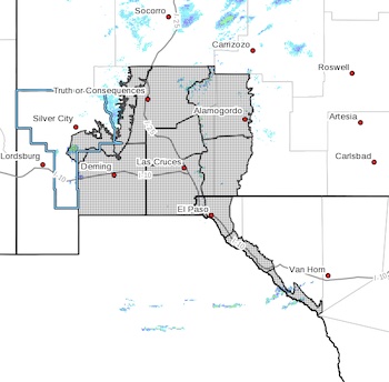
***PERIODS OF LIGHT TO MODERATE SNOW POSSIBLE THROUGH FRIDAY
NIGHT***
A potent winter storm is expected to move through area beginning
this afternoon, lasting into early Saturday morning. The best
chance for accumulating snow will be across portions of Hudspeth
and Otero Counties where a winter storm warning and winter weather
advisory remain in effect. Elsewhere, isolated to scattered rain
and snow showers will be possible. Periods of moderate to heavy
snowfall cannot be ruled out during the overnight periods. This
could cause brief accumulations and travel impacts, especially on
bridges, overpasses, and mountain passes. Little to no snowfall
accumulation is expected for most locations, but a few isolated
areas of 1 to 2 inches cannot be ruled out within these heavier
snow showers.