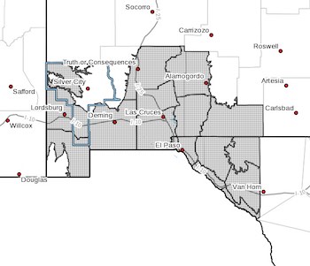
 Upper Gila River Valley-Southwest Desert/Lower Gila River Valley-
Lowlands of the Bootheel-Southwest Desert/Mimbres Basin-
Sierra County Lakes-Northern Dona Ana County-
Southern Dona Ana County/Mesilla Valley-Central Tularosa Basin-
Southern Tularosa Basin-Otero Mesa-Western El Paso County-
Eastern/Central El Paso County-
Northern Hudspeth Highlands/Hueco Mountains-Salt Basin-
Southern Hudspeth Highlands-
Rio Grande Valley of Eastern El Paso/Western Hudspeth Counties-
Rio Grande Valley of Eastern Hudspeth County-
Including the cities of Cliff, Buckhorn, Gila Hot Springs,
Mule Creek, Lordsburg, Red Rock, Virden, Antelope Wells, Animas,
Hachita, Deming, Columbus, Truth Or Consequences, Derry,
Spaceport, Garfield, Hatch, Radium Springs, Las Cruces, Vado,
Sunland Park, Alamogordo, Tularosa, White Sands National Park,
Chaparral, Orogrande, White Sands Range Headquarters, Crow Flats,
Downtown El Paso, West El Paso, Upper Valley,
East and Northeast El Paso, Socorro, Fort Bliss, Hueco Tanks,
Loma Linda, Cornudas, Dell City, Salt Flat, Sierra Blanca,
Fabens, Fort Hancock, Tornillo, and Indian Hot Springs
148 PM MDT Sun Apr 2 2023
...WIND ADVISORY IN EFFECT FROM 3 PM MONDAY TO 9 PM MDT TUESDAY...
* WHAT...West winds 25 to 40 mph with gusts up to 50 mph
expected.
* WHERE...Portions of south central and southwest New Mexico and
southwest Texas.
* WHEN...From 3 PM Monday to 9 PM MDT Tuesday.
* IMPACTS...Gusty winds could blow around unsecured objects.
Tree limbs could be blown down and a few power outages may
result.
* ADDITIONAL DETAILS...Blowing dust will be likely each afternoon,
with visibilities possibly dropping to less than a mile in
isolated areas and instances.
PRECAUTIONARY/PREPAREDNESS ACTIONS...
Use extra caution when driving, especially if operating a high
profile vehicle. Secure outdoor objects.