 RED FLAG WARNING IN EFFECT TUESDAY AND WEDNESDAY AFTERNOON AND EVENING FOR SOUTHWEST AND SOUTH CENTRAL NEW MEXICO AND FAR WEST TEXAS... .Dry, west flow behind developing surface low pressure across the Colorado, New Mexico Plains will lead to increased wind speeds this afternoon and again Wednesday afternoon. Critical fire weather conditions will occur with relative humidity falling to 5 to 10 percent across the majority of New Mexico and west Texas. Warm daytime temperatures will destabilize the near-surface atmosphere, leading to high mixing heights and strong ventilation. West-southwest winds of 15 to 25 mph are expected today, with slightly stronger conditions Wednesday evening..
...RED FLAG WARNING REMAINS IN EFFECT FROM 1 PM TO 9 PM THIS
EVENING FOR WINDY CONDITIONS AND LOW RELATIVE HUMIDITY FOR FIRE
WEATHER ZONES 055, 056, 110, 111, 112, AND 113...
...RED FLAG WARNING IN EFFECT FROM NOON TO 9 PM MDT WEDNESDAY FOR
WINDY CONDITIONS AND LOW RELATIVE HUMIDITY FOR FIRE WEATHER ZONES
055, 056, 110, 111, 112, AND 113...
The National Weather Service in El Paso TX/Santa Teresa has
issued a Red Flag Warning, which is in effect from noon to 9 PM
MDT Wednesday. The Fire Weather Watch is no longer in effect.
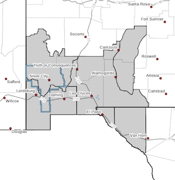
* AFFECTED AREAS...Southwest and South Central New Mexico and Far
West Texas.
* 20 FOOT WINDS...For Tuesday, west-southwest winds 15 to 25 mph
with gusts to 35 mph. For Wednesday, west winds of 20 to 30 mph
with gusts to 40 mph.
* HUMIDITY...5 to 12 percent.
* IMPACTS...any fires that develop will likely spread rapidly.
Outdoor burning is not recommended.
PRECAUTIONARY/PREPAREDNESS ACTIONS...
A Red Flag Warning means that critical fire weather conditions
are either occurring now, or will shortly. A combination of
strong winds, low relative humidity, and warm temperatures can
contribute to extreme fire behavior.