 Southwest Desert/Mimbres Basin-Northern Dona Ana County-Southern
Dona Ana County/Mesilla Valley-West Slopes Sacramento Mountains
Below 7500 Feet-Sacramento Mountains Above 7500 Feet-East Slopes
Sacramento Mountains Below 7500 Feet-West Central Tularosa
Basin/White Sands-Western El Paso County-Eastern/Central El Paso
County-
Including the cities of West El Paso, Socorro, Garfield, Apache
Summit, Timberon, Sunspot, Hatch, Chaparral, Upper Valley, Las
Cruces, Fort Bliss, Mayhill, Deming, White Sands National Park,
Mescalero, Cloudcroft, Vado, East and Northeast El Paso, Downtown
El Paso, Radium Springs, White Sands Range Headquarters,
Sacramento, Mountain Park, Pinon, Sunland Park, and Columbus
1200 PM MDT Fri Apr 26 2024
...WIND ADVISORY IN EFFECT FROM NOON TO 8 PM MDT SATURDAY...
* WHAT...West winds 25 to 35 mph with gusts up to 50 mph expected.
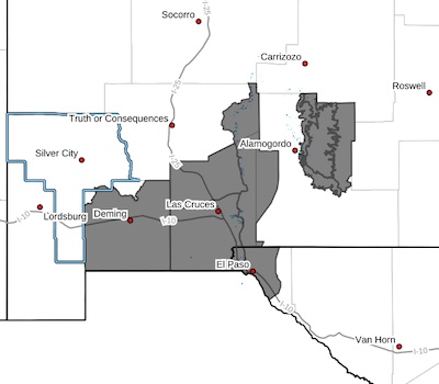
* WHERE...Sacramento Mountains, Southwest Desert/Mimbres Basin,
Northern Dona Ana County, Southern Dona Ana County/Mesilla Valley,
West Central Tularosa Basin/White Sands, Western El Paso County,
and Eastern/Central El Paso County.
* WHEN...From noon to 8 PM MDT Saturday.
* IMPACTS...Gusty winds will blow around unsecured objects. Tree
limbs could be blown down and a few power outages may result.
* ADDITIONAL DETAILS...The peak winds are expected between 2pm and
6pm. In addition to the winds, blowing dust could reduce
visibilities to 1-2 miles.
PRECAUTIONARY/PREPAREDNESS ACTIONS...
Winds this strong can make driving difficult, especially for high
profile vehicles. Use extra caution.