 CRITICAL FIRE WEATHER CONDITIONS THROUGH WEDNESDAY... .A persistent trough over the Northern Rockies will maintain dry west flow across the U.S. Southwest over the next several days. Disturbances within this prevailing flow will allow winds to increase area-wide into the middle of the week. Gusty winds will develop each afternoon combining with very low relative humidity to create critical to extreme fire danger. Recent lack of precipitation has progressed fuel dryness to a point where wildfire starts will be possible and spread aided by weather conditions.
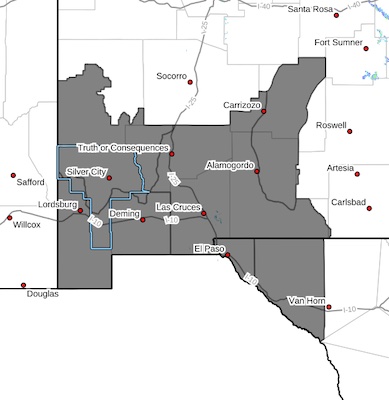
Southwest Mountains/Gila NF/Apache NF/GLZ-
Southwest Deserts and Lowlands/Las Cruces BLM/GLZ-
South Central Lowlands and Southern Rio Grande Valley/BLM/GLZ-
Capitan and Sacramento Mountains/Lincoln NF/LNZ-
256 AM MDT Sat May 4 2024
...RED FLAG WARNING IN EFFECT FROM NOON TO 9 PM MDT MONDAY FOR
STRONG WINDS AND LOW HUMIDITY FOR SOUTHERN NEW MEXICO ZONES...
...RED FLAG WARNING IN EFFECT FROM NOON TO 9 PM MDT TUESDAY FOR STRONG WINDS AND LOW HUMIDITY FOR SOUTHERN NEW MEXICO ZONES...
...FIRE WEATHER WATCH IN EFFECT FROM WEDNESDAY AFTERNOON THROUGH
TUESDAY EVENING FOR STRONG WINDS AND LOW HUMIDITY...
* AFFECTED AREA...Fire Weather Zone 110 Southwest Mountains/Gila
NF/Apache NF/GLZ, Fire Weather Zone 111 Southwest Deserts and
Lowlands/Las Cruces BLM/GLZ, Fire Weather Zone 112 South
Central Lowlands and Southern Rio Grande Valley/BLM/GLZ and
Fire Weather Zone 113 Capitan and Sacramento Mountains/Lincoln
NF/LNZ.
*TIMING...For the Red Flag Warnings, from Noon to 9PM Monday and
Tuesday. For the Fire Weather Watch, Wednesday afternoon and
evening.
* WINDS...West 20 to 30 mph with gusts up to 45 mph.
* RELATIVE HUMIDITY...5 to 12 percent.
* TEMPERATURES...In the 80s to near 90.
* EXPERIMENTAL RFTI...For Monday, 3 to 6 Near Critical to
Critical. For Tuesday, 5 to 8 Critical to Extreme. For
Wednesday, 4 to 6 Near Critical to Critical.
* IMPACTS...Any fires that develop will likely spread rapidly.
Outdoor burning is not recommended.
PRECAUTIONARY/PREPAREDNESS ACTIONS...
A Red Flag Warning means that critical fire weather conditions
are either occurring now, or will shortly. A combination of
strong winds, low relative humidity, and warm temperatures can
contribute to extreme fire behavior.
A Fire Weather Watch means that critical fire weather conditions
are forecast to occur. Listen for later forecasts and possible
Red Flag Warnings.