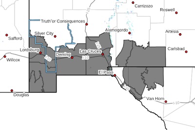
 Southwest Desert/Lower Gila River Valley-Lowlands of the Bootheel-Uplands of the Bootheel-Southwest Desert/Mimbres Basin-Northern Dona Ana County-Southern Dona Ana County/Mesilla Valley-Otero Mesa-Southeast Tularosa Basin-Western El Paso County-Northern Hudspeth Highlands/Hueco Mountains-Salt Basin-Rio Grande Valley of Eastern El Paso/Western Hudspeth Counties-
Including the cities of Antelope Wells, Deming, Fort Hancock, Red
Rock, Dell City, West El Paso, Vado, Sunland Park, Fabens,
Columbus, Crow Flats, Cloverdale, Radium Springs, Upper Valley,
Garfield, Las Cruces, Hachita, Hueco Tanks, Hatch, Virden,
Cornudas, Salt Flat, Tornillo, Downtown El Paso, Loma Linda,
Lordsburg, Animas, and Orogrande
633 AM MST Wed Feb 18 2026
...BLOWING DUST ADVISORY IN EFFECT FROM 11 AM THIS MORNING TO 6 PM
MST THIS EVENING...
...WIND ADVISORY REMAINS IN EFFECT FROM 11 AM THIS MORNING TO 8 PM
MST THIS EVENING...
* WHAT...For the Blowing Dust Advisory, visibility between
one-quarter and one mile in blowing dust expected. For the Wind
Advisory, west winds 25 to 35 mph with gusts up to 60 mph expected.
* WHERE...Portions of south central and southwest New Mexico and
southwest Texas.
* WHEN...For the Blowing Dust Advisory, from 11 AM this morning to 6
PM MST this evening. For the Wind Advisory, from 11 AM this
morning to 8 PM MST this evening.
* IMPACTS...Hazardous driving conditions due to reduced visibility.
Gusty winds will blow around unsecured objects. Tree limbs could
be blown down and a few power outages may result.
PRECAUTIONARY/PREPAREDNESS ACTIONS...
Persons with respiratory problems should make preparations to stay
indoors until the storm passes. Be ready for a sudden drop in
visibility to near zero. If you encounter blowing dust or blowing
sand on the roadway or see it approaching, pull off the road as far
as possible and put your vehicle in park. Turn the lights all the
way off and keep foot off the brake pedal. Remember, 'Pull Aside,
Stay Alive'.
Winds this strong can make driving difficult, especially for high
profile vehicles. Use extra caution.