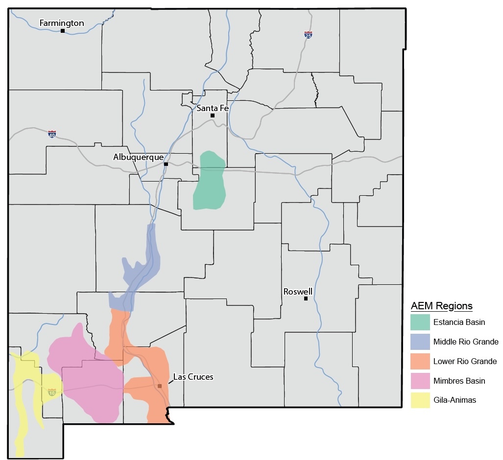
Map below
The New Mexico State Geologist and director of the New Mexico Bureau of Geology and Mineral Resources at New Mexico Tech,J. Michael Timmons, sent this news release about activities that will involve airborne geophysical surveys in the area over the next few weeks.
Timmons said: " I have some very exciting news related to aquifer characterization studies in New Mexico. With the first special appropriation of $7.5 million to the New Mexico Bureau of Geology in FY26 for aquifer mapping, we are initiating a series of airborne geophysical surveys that will enhance our understanding of the state's groundwater. These surveys represent the most advanced techniques available for imaging and interpreting the subsurface geology, enabling a deeper understanding of our fresh and brackish groundwater resources."
In November and December 2025, New Mexico Tech and the New Mexico Bureau of Geology will have contractors conduct low-altitude aerial geophysical surveys in several regions. The regions are shown in the attached image and in the Facebook link below. The first flights are scheduled to start on November 15 in Truth or Consequences, heading south toward Las Cruces over the following 15-20 days. Simultaneously, flights will begin near Silver City, heading toward Lordsburg and south for 15-20 days. Beginning the week of Nov. 17, there will be flights in the Mimbres Basin near Deming. The San Acacia reach of the Rio Grande is expected to be in mid-December, as well as the Estancia Basin.
A helicopter equipped with specialized instruments will fly about 100 feet above ground, collecting data along pre-planned flight paths. The instruments measure the electromagnetic responses of geological materials, such as sand, gravel, and clay. When combined with well and geological data, the results will help create three-dimensional maps of aquifer systems in the region.
More information at https://www.facebook.com/NMBGMR/posts/pfbid02wBCn3xVEq6ckqR74xSWwuqguphiNACeRJk15WwqW22Gydx2npVnAskodVX46d9HHl?rdid=gdVyn50UMCicVDRc