


 Southwest Desert/Lower Gila River Valley-Lowlands of the Bootheel- Uplands of the Bootheel-Southwest Desert/Mimbres Basin-Sierra County Lakes-Northern Dona Ana County-Southern Dona Ana County/Mesilla Valley-West Central Tularosa Basin/White Sands-
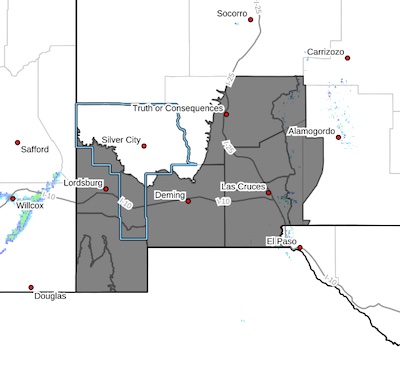
Including the cities of Truth Or Consequences, Hachita, Radium Springs, Chaparral, Red Rock, Garfield, Animas, Deming, White Sands National Park, Antelope Wells, White Sands Range
Headquarters, Sunland Park, Spaceport, Hatch, Derry, Columbus, Virden, Las Cruces, Lordsburg, Cloverdale, and Vado
516 AM MDT Mon Jul 28 2025
...FLOOD WATCH IN EFFECT FROM 3 PM MDT THIS AFTERNOON THROUGH LATE TONIGHT...
* WHAT...Flooding caused by excessive rainfall is possible.
* WHERE...Portions of south central and southwest New Mexico,
including the following areas, in south central New Mexico,
Northern Dona Ana County, Sierra County Lakes, Southern Dona Ana
County/Mesilla Valley and West Central Tularosa Basin/White Sands.
In southwest New Mexico, Lowlands of the Bootheel, Southwest
Desert/Lower Gila River Valley, Southwest Desert/Mimbres Basin and
Uplands of the Bootheel.
* WHEN...From 3 PM MDT this afternoon through late tonight.
* IMPACTS...Excessive runoff may result in flooding of rivers,
streams, arroyos, drainage channels, and other low-lying and
flood-prone locations. Flooding may occur in poor drainage and
urban areas. Low-water crossings may be flooded. Extensive street
flooding and even flooding of homes and businesses are possible.
* ADDITIONAL DETAILS...
- Thunderstorms with heavy rainfall rates, and slow storm
motion.
- http://www.weather.gov/safety/flood
PRECAUTIONARY/PREPAREDNESS ACTIONS...
You should monitor later forecasts and be alert for possible Flood
Warnings. Those living in areas prone to flooding should be prepared
to take action should flooding develop.


