


 Moisture from the remnants of former Tropical Storm Priscilla will mostly stay north and west of the area today. But increasing moisture from the remnants of Tropical Storm Raymond will get pulled into the area this afternoon and interact with a slow-moving upper level trough, possibly lasting through Monday. Expect increasing showers and thunderstorms in Southwestern New Mexico this afternoon and overnight, with localized torrential downpours. Additional bouts of tropical showers and isolated thunderstorms will continue on Sunday, especially in the Bootheel Region. Rain coverage in the Gila Region is a little less certain on Sunday. Additional rainfall is possible on Monday, and this Flood Watch may need to be extended later as forecasts come into sharper focus.
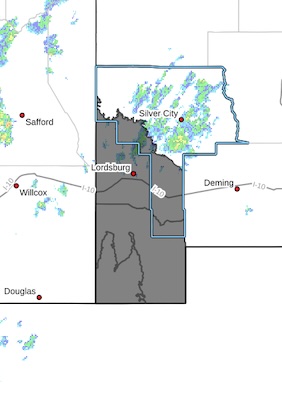
Southwest Desert/Lower Gila River Valley-Lowlands of the Bootheel-
Uplands of the Bootheel-
Including the cities of Virden, Lordsburg, Cloverdale, Red Rock,
Hachita, Animas, and Antelope Wells
356 AM MDT Sat Oct 11 2025
...FLOOD WATCH IN EFFECT FROM 2 PM MDT THIS AFTERNOON THROUGH SUNDAY
AFTERNOON...
* WHAT...Flooding caused by excessive rainfall is possible.
* WHERE...Portions of southwestern New Mexico, including the
Bootheel Region, all of Hidalgo County, and southern Grant County.
* WHEN...From 2 PM MDT this afternoon through Sunday afternoon.
* IMPACTS...The risk of localized flash flooding will mainly be this
afternoon and overnight Saturday night, as thunderstorms with
torrential downpours develop. Flooding is possible in arroyos, low
water crossings, and low-lying areas with poor drainage. This will
be followed by more moderate rainfall rates on Sunday, mainly
focused over the Bootheel Region. While tributary arroyo flows may
diminish on Sunday, some of the slower-reacting main washes, such
as Animas Creek, may continue to flood, and could cut off access
to some rural roads in the Bootheel.
* ADDITIONAL DETAILS...
- http://www.weather.gov/safety/flood
PRECAUTIONARY/PREPAREDNESS ACTIONS...
You should monitor later forecasts and be alert for possible Flood
Warnings. Those living in areas prone to flooding should be prepared
to take action should flooding develop.


