


 CRITICAL FIRE WEATHER CONDITIONS POSSIBLE TUESDAY FOR SOUTHWEST NEW MEXICO AND FAR WEST TEXAS... .Approaching low pressure system moving on shore over the Pacific Northwest will induce stronger southwest flow aloft over the Southern Rockies early next week. Subsequent tightening of the surface pressure gradient will increase winds area wide. Strongest winds are forecast to occur Tuesday and Wednesday afternoons, with gusty west winds midday. Drier air will also move in and create critical fire danger for much of southern New Mexico and far west Texas. Recent rains over mountain forests may reduce fire risk somewhat, but weather conditions will be favorable for rapid drying of fine fuels and increasing ERCs back above seasonal normals.
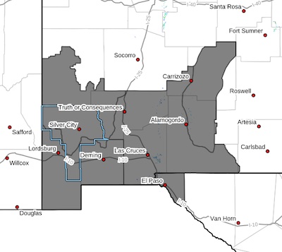
Southwest Mountains/Gila NF/Apache NF/GLZ-
Southwest Deserts and Lowlands/Las Cruces BLM/GLZ-
South Central Lowlands and Southern Rio Grande Valley/BLM/GLZ-
Capitan and Sacramento Mountains/Lincoln NF/LNZ-
Texas Fire Weather Zone 055
El Paso County-
108 PM MDT Fri May 9 2025
...FIRE WEATHER WATCH IN EFFECT NEXT TUESDAY FOR STRONG WINDS AND
LOW HUMIDITY FOR SOUTHWEST NEW MEXICO AND FAR WEST TEXAS...
* AFFECTED AREA...In Texas, Fire Weather Zone 055 El Paso County.
In New Mexico, Fire Weather Zone 110 Southwest Mountains/Gila
NF/Apache NF/GLZ, Fire Weather Zone 111 Southwest Deserts and
Lowlands/Las Cruces BLM/GLZ, Fire Weather Zone 112 South Central
Lowlands and Southern Rio Grande Valley/BLM/GLZ and Fire Weather
Zone 113 Capitan and Sacramento Mountains/Lincoln NF/LNZ.
* WINDS...West 25 to 35 mph with gusts up to 50 mph.
* RELATIVE HUMIDITY...9 to 14 percent.
* EXPERIMENTAL RFTI...6 to 7 or Critical to Extreme.
* IMPACTS...any fires that develop will likely spread rapidly.
Outdoor burning is not recommended.
PRECAUTIONARY/PREPAREDNESS ACTIONS...
A Fire Weather Watch means that critical fire weather conditions
are forecast to occur. Listen for later forecasts and possible
Red Flag Warnings.


