


 Southwest Desert/Mimbres Basin-Eastern Black Range Foothills-
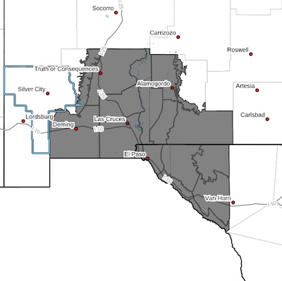
Sierra County Lakes-Northern Dona Ana County-Southern Dona Ana
County/Mesilla Valley-West Slopes Sacramento Mountains Below
7500 Feet-Otero Mesa-West Central Tularosa Basin/White Sands-East
Central Tularosa Basin/Alamogordo-Southeast Tularosa Basin-
Western El Paso County-Eastern/Central El Paso County-Northern
Hudspeth Highlands/Hueco Mountains-Salt Basin-Southern Hudspeth
Highlands-Rio Grande Valley of Eastern El Paso/Western Hudspeth
Counties-Rio Grande Valley of Eastern Hudspeth County-
Including the cities of Deming, Dell City, Fort Hancock, Sunland Park, Radium Springs, White Sands Range Headquarters, Orogrande,
East and Northeast El Paso, Fort Bliss, White Sands National
Park, Hatch, Tornillo, Sierra Blanca, Chaparral, Crow Flats,
Tularosa, Mescalero, Holloman AFB, Alamogordo, Hillsboro,
Timberon, Las Cruces, Salt Flat, Upper Valley, Derry, Mountain
Park, Truth Or Consequences, Socorro, Winston, Garfield,
Cornudas, Vado, West El Paso, Loma Linda, Fabens, Spaceport,
Hueco Tanks, Columbus, Downtown El Paso, and Indian Hot Springs
355 AM MDT Sun Mar 16 2025
...HIGH WIND WATCH IN EFFECT FROM TUESDAY AFTERNOON THROUGH TUESDAY
EVENING...
* WHAT...West winds 35 to 45 mph with gusts 55 to 65 mph possible.
* WHERE...Portions of south central and southwest New Mexico and Far
West Texas. Including El Paso, and Hudspeth counties in Texas, and
Otero, Dona Ana, Sierra, and Luna counties in New Mexico.
* WHEN...From Tuesday afternoon through Tuesday evening.
* IMPACTS...Damaging winds could blow down trees and power lines.
Widespread power outages are possible. Travel could be difficult,
especially for high profile vehicles. Widespread blowing dust,
with near zero visibility will make for dangerous travel
conditions. Critical Wildfire conditions are expected.
PRECAUTIONARY/PREPAREDNESS ACTIONS...
Monitor the latest forecasts and warnings for updates.
Fasten loose objects or shelter objects in a safe location prior to
the onset of winds.


