


 CRITICAL TO EXTREME FIRE DANGER FOR SOUTHERN NEW MEXICO AND FAR WEST TEXAS ON SUNDAY... .An upper-level low will move through the Great Basin on Sunday, which will steer the jet stream across New Mexico during the afternoon. Meanwhile, a surface low will develop over eastern Colorado increasing winds across the area. These strong winds will combine with very low relative humidity at all elevations and very dry fuels to create critical to extreme fire weather conditions Sunday afternoon.
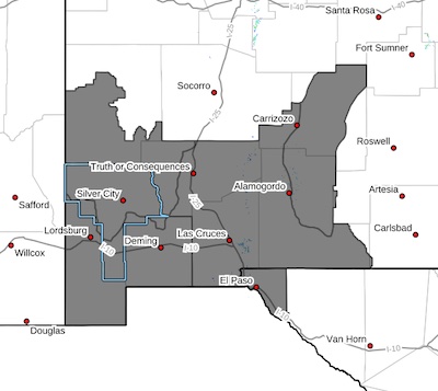
Southwest Mountains/Gila NF/Apache NF/GLZ-
Southwest Deserts and Lowlands/Las Cruces BLM/GLZ-South Central Lowlands and Southern Rio Grande Valley/BLM/GLZ-Capitan and Sacramento Mountains/Lincoln NF/LNZ-Texas Fire Weather Zone 055
El Paso County-
142 PM MDT Thu Apr 24 2025
...FIRE WEATHER WATCH IN EFFECT FROM SUNDAY MORNING THROUGH
SUNDAY EVENING FOR STRONG WINDS, VERY LOW RELATIVE HUMIDITY, AND
CRITICALLY DRY FUELS FOR SOUTHWEST AND SOUTH CENTRAL NEW MEXICO,
AND EL PASO COUNTY IN FAR WEST TEXAS...
* AFFECTED AREA...Fire Weather Zone 055 Texas Fire Weather Zone
055 El Paso County, Fire Weather Zone 110 Southwest
Mountains/Gila NF/Apache NF/GLZ, Fire Weather Zone 111
Southwest Deserts and Lowlands/Las Cruces BLM/GLZ, Fire
Weather Zone 112 South Central Lowlands and Southern Rio
Grande Valley/BLM/GLZ and Fire Weather Zone 113 Capitan and
Sacramento Mountains/Lincoln NF/LNZ.
* TIMING...From 11 AM To 9 PM Sunday
* WINDS...Southwest 25 to 35 mph with gusts up to 55 mph.
* RELATIVE HUMIDITY...As low as 5 percent.
* EXPERIMENTAL RFTI...5 to 8 Critical to Extreme
* IMPACTS...any fires that develop will likely spread rapidly.
Outdoor burning is not recommended
PRECAUTIONARY/PREPAREDNESS ACTIONS...
A Fire Weather Watch means that critical fire weather conditions
are forecast to occur. Listen for later forecasts and possible
Red Flag Warnings.


