


 CRITICAL FIRE WEATHER CONDITIONS POSSIBLE MONDAY SOUTHWEST NM AND FOR SOUTHWEST NEW MEXICO AND FAR WEST TEXAS TUESDAY... .Approaching low pressure system moving on shore over the Pacific Northwest will induce stronger southwest flow aloft over the Southern Rockies early next week. Subsequent tightening of the surface pressure gradient will increase winds area wide. Strongest winds are forecast to occur Tuesday and Wednesday afternoons, but will be picking up out west by Monday afternoon. Drier air will also move in and create critical fire danger for much of southern New Mexico and far west Texas. Recent rains over mountain forests may reduce fire risk somewhat, but weather conditions will be favorable for rapid drying of fine fuels and increasing ERCs back above seasonal normals.
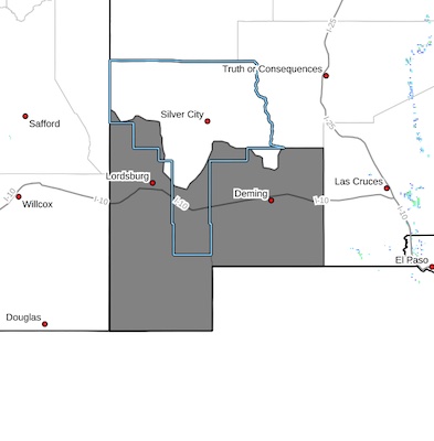
Southwest Deserts and Lowlands/Las Cruces BLM/GLZ-
147 PM MDT Sat May 10 2025
...FIRE WEATHER WATCH IN EFFECT FROM MONDAY AFTERNOON THROUGH
MONDAY EVENING FOR STRONG WINDS AND LOW HUMIDITY FOR FAR SOUTHWEST
NEW MEXICO...
...FIRE WEATHER WATCH REMAINS IN EFFECT FROM TUESDAY AFTERNOON
THROUGH TUESDAY EVENING FOR STRONG WINDS AND LOW HUMIDITY FOR FAR
SOUTHWEST NEW MEXICO...
The National Weather Service in El Paso Tx/Santa Teresa has
issued a Fire Weather Watch for strong winds and low relative
humidity, which is in effect from Monday afternoon through Monday
evening.
* AFFECTED AREA...Fire Weather Zone 111 Southwest Deserts and
Lowlands/Las Cruces BLM/GLZ.
* TIMING...Monday and Tuesday afternoon and evening. 11 a.m. -9 p.m.
* WINDS...West 20 to 30 mph with gusts up to 40 mph Monday and 25
to 35 mph with gusts to 50 mph Tuesday.
* RELATIVE HUMIDITY...As low as 8 percent Monday and 10 percent
Tuesday.
* TEMPERATURES...88 to 93.
* EXPERIMENTAL RFTI...6 to 7 or Critical to Extreme.
* IMPACTS...Any fires that develop will likely spread rapidly.
Outdoor burning is not recommended.
PRECAUTIONARY/PREPAREDNESS ACTIONS...
A Fire Weather Watch means that critical fire weather conditions
are forecast to occur. Listen for later forecasts and possible
Red Flag Warnings.


