


 RED FLAG WARNING IN EFFECT TUESDAY AFTERNOON AND EVENING FOR SOUTHWEST AND SOUTH CENTRAL NEW MEXICO AND FAR WEST TEXAS... ...FIRE WEATHER WATCH IN EFFECT WEDNESDAY AFTERNOON AND EVENING FOR SOUTHWEST AND SOUTH CENTRAL NEW MEXICO AND FAR WEST TEXAS... .A Western U.S. trough pattern will bring a prolonged period of elevated to critical fire weather conditions to Southern New Mexico and Far West Texas. Daily temperatures will run warmer than seasonal normals, by about 5 degrees for the week, leading to an unstable atmosphere with enhanced lifting. In addition the deep westerly flow will keep the atmosphere quite dry with single-digit daily minimum relative humidity and poor overnight recoveries in the 25 to 35 percent range. Finally, southwesterly and westerly winds will be strong, with each afternoon being high-end breezy to moderately windy. Conditions are expected to moderate slightly by Friday with lighter winds from the north.
...RED FLAG WARNING IN EFFECT FROM 1 PM TO 9 PM MDT TUESDAY FOR
LOW HUMIDITY AND STRONG WINDS FOR FIRE WEATHER ZONES 055, 056,
110, 111, 112, AND 113...
...FIRE WEATHER WATCH IN EFFECT FROM
WEDNESDAY AFTERNOON THROUGH WEDNESDAY EVENING FOR LOW HUMIDITY AND
STRONG WINDS FOR FIRE WEATHER ZONES 055, 056, 110, 111, 112, AND
113...
The National Weather Service in El Paso Tx/Santa Teresa has
issued a Red Flag Warning, which is in effect from 1 PM to 9 PM
MDT Tuesday. a Fire Weather Watch has also been issued. This Fire
Weather Watch is in effect from Wednesday afternoon through
Wednesday evening.
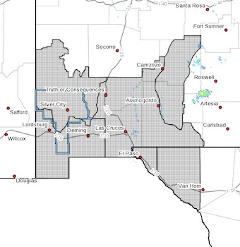
* AFFECTED AREAS...Southwest and South Central New Mexico and Far
West Texas. Including the lower elevations of the Gila region,
the southwest and south central New Mexico lowlands, the
Sacramento and Capitan mountains, and El Paso and Hudspeth
counties in Far West Texas.
* 20 FOOT WINDS...For Tuesday, southwest to west winds 20 to 25
mph with gusts to 35 mph. For Wednesday, west winds of 25 to 30
mph with gusts 40 to 55 mph.
* HUMIDITY...Lowland minimums 5 to 10 percent. Mountain minimums
10 to 15 percent. Overnight recoveries poor at only 25 to 35
percent.
* IMPACTS...any fires that develop will likely spread rapidly.
Outdoor burning is not recommended.
PRECAUTIONARY/PREPAREDNESS ACTIONS...
A Red Flag Warning means that critical fire weather conditions
are either occurring now, or will shortly. A combination of
strong winds, low relative humidity, and warm temperatures can
contribute to extreme fire behavior.
A Fire Weather Watch means that critical fire weather conditions
are forecast to occur. Listen for later forecasts and possible
Red Flag Warnings.